Air Ambulance Helicopter to Trefriw, Crafnant Road
Sunday, 12 April 2026 | 17:43 | From Caernarfon Airport
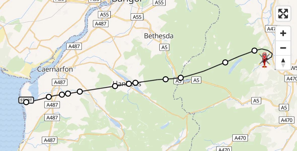
On Sunday, 12 April 2026 at 17:43, a Air Ambulance Helicopter departed from Caernarfon Airport to Trefriw. It was the Air Ambulance Helicopter with registration number G-WENU. The flight lasted 17 minutes. During that period, the aircraft travelled 25 miles at an average speed of 91 miles per hour at a maximum altitude of 3550 feet.
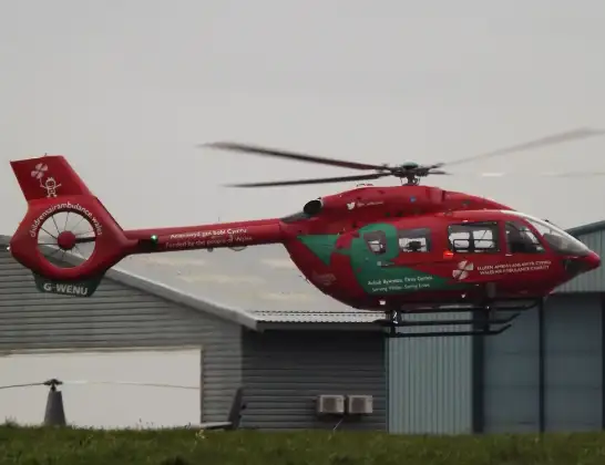
Helicopter: G-WENU
The helicopter G-WENU is used as a air ambulance helicopter. The main purpose of this aircraft is to transport a Mobile Medical Team to an incident as quickly as possible, enabling the trauma doctor to provide immediate first aid on site. The aircraft is flying this flight as Air Ambulance Helicopter.
Photo: James from Cheltenham, Gloucestershire
26 miles
3550 feet
91 mph
17 minutes
17:43
18:00

Route
Crafnant Road, Conwy18:00
Trefriw, Conwy17:54
Dolgarrog, Conwy17:53
Capel Curig, Conwy17:51
Llandygai, Gwynedd17:51
Llanberis, Gwynedd17:50
Llyn Padarn17:50
Llanberis, Gwynedd17:49
Waunfawr, Gwynedd17:48
Bontnewydd, Gwynedd17:47
Rhostryfan, Gwynedd17:47
Llanwnda, Gwynedd17:47
Llanfaglan, Gwynedd17:46
Caernarfon Airport, Caernarfon17:45
Caernarfon Airport, Caernarfon17:43
Live flights
Today
Police Helicopter to Manchester Barton Aerodrome13 Jul 23:56
Police Helicopter to Bournemouth Airport13 Jul 23:55
Air Ambulance Helicopter to Cardiff Heliport13 Jul 23:38
Police Helicopter to Birmingham Airport13 Jul 23:21
Police Helicopter to Irlam, Twelve Yards Road13 Jul 23:00
Flights Trefriw
Police Helicopter to Trefriw, Crafnant Road11 May 14:44
Air Ambulance Helicopter to Trefriw25 Apr 16:26
Air Ambulance Helicopter to Trefriw, Gower Road25 Apr 16:06
Air Ambulance Helicopter to Caernarfon Airport12 Apr 18:33
Coastguard Helicopter to Caernarfon Airport4 Mar 10:34
Coastguard Helicopter to Trefriw4 Mar 10:21
Helicopter flights on your website?
You can easily display helicopter flights on your own website. Use the embed code.
