Air Ambulance Helicopter to Topcliffe, A168
Sunday, 12 April 2026 | 17:32 | From RAF Topcliffe
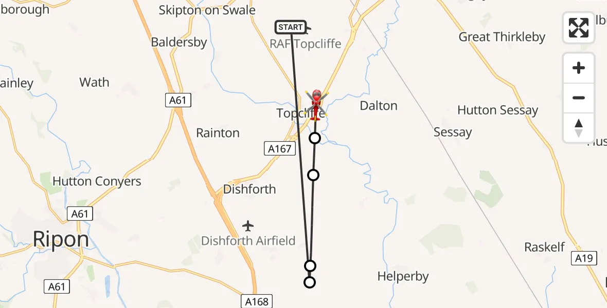
On Sunday, 12 April 2026 at 17:32, a Air Ambulance Helicopter departed from RAF Topcliffe to Topcliffe. It was the Air Ambulance Helicopter with registration number G-YORX. The flight lasted 3 minutes. During that period, the aircraft travelled 10 miles at an average speed of 187 miles per hour at a maximum altitude of 2075 feet.
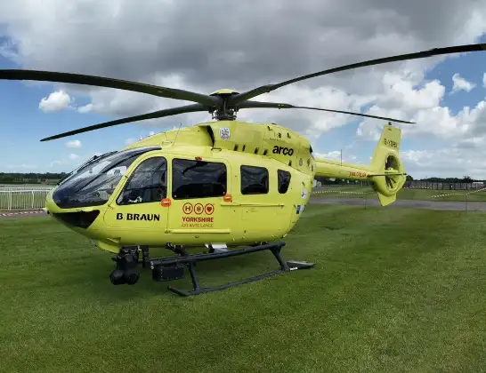
Helicopter: G-YORX
The helicopter G-YORX is used as a air ambulance helicopter. The main purpose of this aircraft is to transport a Mobile Medical Team to an incident as quickly as possible, enabling the trauma doctor to provide immediate first aid on site. The aircraft is flying this flight as Air Ambulance Helicopter.
Photo: Arollin96227
11 miles
2075 feet
187 mph
4 minutes
17:32
17:35

Route
A168, North Yorkshire17:35
Asenby, North Yorkshire17:35
Cundall with Leckby, North Yorkshire17:34
Norton-le-Clay, North Yorkshire17:33
Kirby Hill, North Yorkshire17:33
RAF Topcliffe, Thirsk, North Yorkshire17:32
Live flights
Today
Flights Topcliffe
Air Ambulance Helicopter to Topcliffe, A16812 Apr 17:32
Air Ambulance Helicopter to RAF Topcliffe8 Mar 12:49
Air Ambulance Helicopter to Topcliffe, A1688 Mar 12:36
Air Ambulance Helicopter to Topcliffe31 Jan 12:07
Air Ambulance Helicopter to Topcliffe31 Jan 11:51
Helicopter flights on your website?
You can easily display helicopter flights on your own website. Use the embed code.
