Air Ambulance Helicopter to Topcliffe
Saturday, 31 January 2026 | 12:07 | From Topcliffe
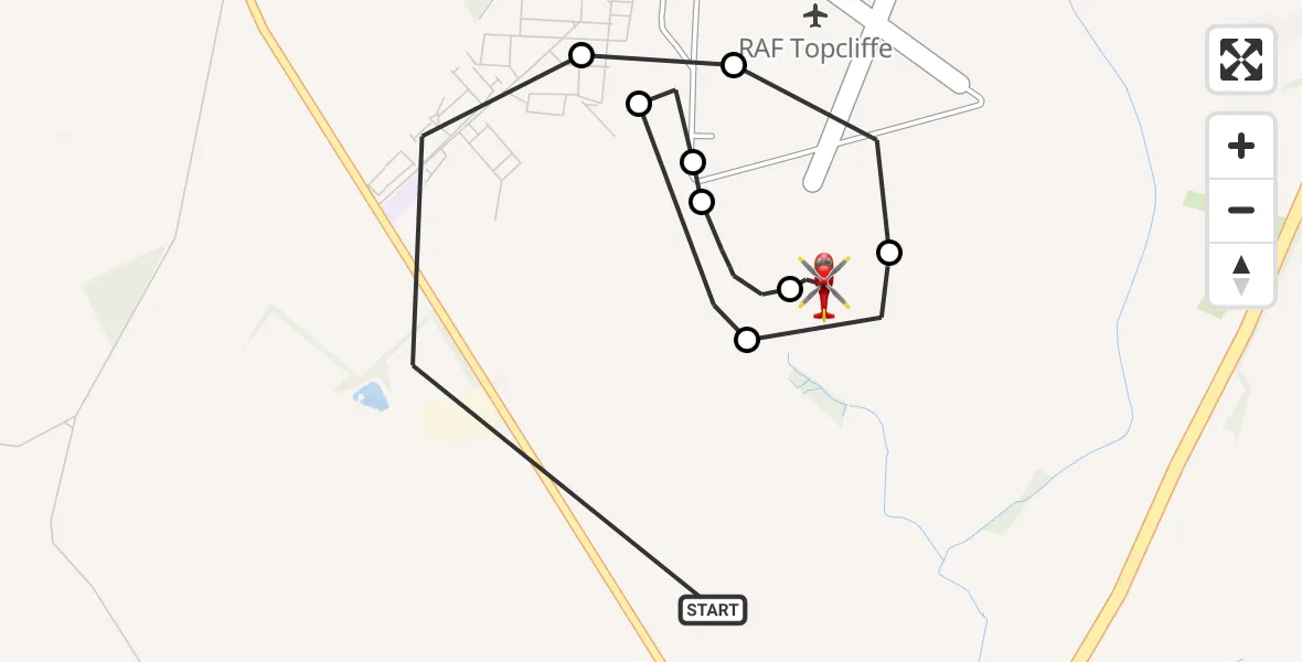
On Saturday, 31 January 2026 at 12:07, a Air Ambulance Helicopter departed from Topcliffe to Topcliffe. It was the Air Ambulance Helicopter with registration number G-YAAA. The flight lasted 6 minutes. During that period, the aircraft travelled 4 miles at an average speed of 41 miles per hour at a maximum altitude of 1225 feet.
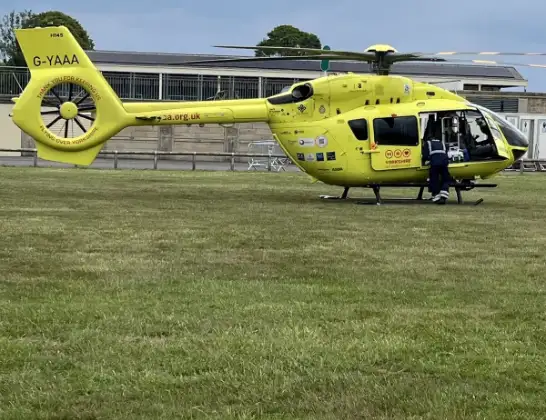
Helicopter: G-YAAA
The helicopter G-YAAA is used as a air ambulance helicopter. The main purpose of this aircraft is to transport a Mobile Medical Team to an incident as quickly as possible, enabling the trauma doctor to provide immediate first aid on site. The aircraft is flying this flight as Air Ambulance Helicopter.
Photo: Jennifer Petrie
5 miles
1225 feet
41 mph
7 minutes
12:07
12:13

Route
Topcliffe, Thirsk12:13
Topcliffe, Thirsk12:12
Trenchard Street, York and North Yorkshire12:12
Trenchard Street, York and North Yorkshire12:11
Topcliffe, York and North Yorkshire12:11
RAF Topcliffe, Thirsk, North Yorkshire12:10
Topcliffe, Thirsk12:10
Topcliffe, York and North Yorkshire12:09
Topcliffe, Thirsk12:08
RAF Topcliffe, Thirsk, North Yorkshire12:08
Topcliffe, Thirsk12:07
A167, York and North Yorkshire12:07
Live flights
Police Helicopter on its way from Ewelme13 Jul 22:24
Today
Police Helicopter to Bournemouth Airport13 Jul 23:55
Air Ambulance Helicopter to Cardiff Heliport13 Jul 23:38
Police Helicopter to Birmingham Airport13 Jul 23:21
Police Helicopter to Irlam, Twelve Yards Road13 Jul 23:00
Flights Topcliffe
Air Ambulance Helicopter to Topcliffe, A16812 Apr 17:32
Air Ambulance Helicopter to RAF Topcliffe8 Mar 12:49
Air Ambulance Helicopter to Topcliffe, A1688 Mar 12:36
Air Ambulance Helicopter to Topcliffe31 Jan 12:07
Air Ambulance Helicopter to Topcliffe31 Jan 11:51
Helicopter flights on your website?
You can easily display helicopter flights on your own website. Use the embed code.
