Air Ambulance Helicopter to Culgaith
Saturday, 11 April 2026 | 16:27 | From Warcop
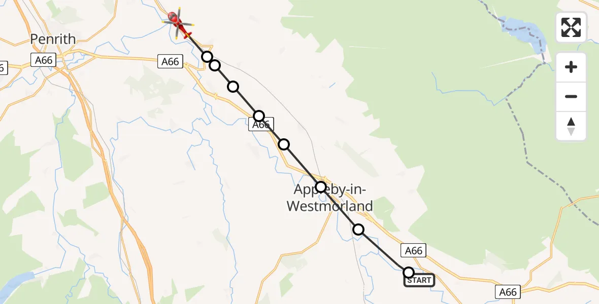
On Saturday, 11 April 2026 at 16:27, a Air Ambulance Helicopter departed from Warcop to Culgaith. It was the Air Ambulance Helicopter with registration number G-NHAE. The flight lasted 5 minutes. During that period, the aircraft travelled 13 miles at an average speed of 173 miles per hour at a maximum altitude of 2700 feet.
Helicopter: G-NHAE
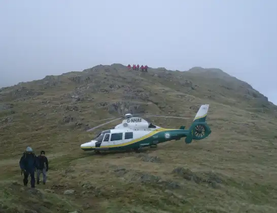
The helicopter G-NHAE is used as a air ambulance helicopter. The main purpose of this aircraft is to transport a Mobile Medical Team to an incident as quickly as possible, enabling the trauma doctor to provide immediate first aid on site. The aircraft is flying this flight as Air Ambulance Helicopter.
Photo: Michael Earnshaw
14 miles
2700 feet
173 mph
5 minutes
16:27
16:32

Route
Culgaith, Westmorland and Furness16:32
Culgaith, Westmorland and Furness16:31
Temple Sowerby, Westmorland and Furness16:31
Newbiggin, Westmorland and Furness16:31
Kirkby Thore, Westmorland and Furness16:30
Crackenthorpe, Westmorland and Furness16:30
Appleby-in-Westmorland, Westmorland and Furness16:29
Murton, Westmorland and Furness16:28
Sandford, Westmorland and Furness16:27
B6259, Westmorland and Furness16:27
Live flights
Today
Flights Culgaith
Air Ambulance Helicopter to Egglescliffe7 Apr 10:36
Air Ambulance Helicopter to Culgaith, Ousby6 Apr 20:46
Air Ambulance Helicopter to Stanhope6 Apr 19:43
Air Ambulance Helicopter to Culgaith2 Apr 18:54
Air Ambulance Helicopter to Culgaith2 Apr 18:30
Air Ambulance Helicopter to Culgaith, B64121 Apr 15:24
Air Ambulance Helicopter to Culgaith, B641231 Mar 13:34
Flights Warcop
Helicopter flights on your website?
You can easily display helicopter flights on your own website. Use the embed code.
