Police Helicopter to Rockbeare, Westcott Road
Saturday, 11 April 2026 | 21:32 | From Exeter International Airport
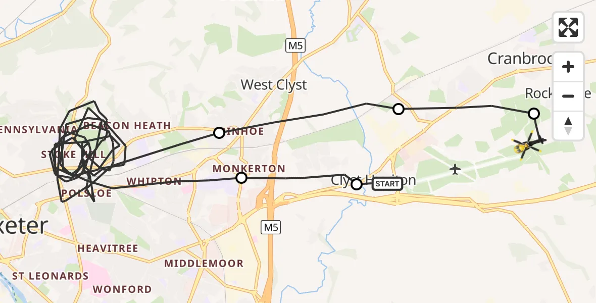
On Saturday, 11 April 2026 at 21:32, a Police Helicopter departed from Exeter International Airport to Rockbeare. It was the Police Helicopter with registration number G-CPAS. The flight lasted 28 minutes. During that period, the aircraft travelled 23 miles at an average speed of 51 miles per hour at a maximum altitude of 2350 feet.

Helicopter: G-CPAS
The helicopter G-CPAS is used by the British police. The helicopter is deployed in pursuits, missing persons cases and other incidents where a helicopter provides added value.
24 miles
2350 feet
51 mph
28 minutes
21:32
22:00

Route
Westcott Road, Devon22:00
Rockbeare, Devon21:59
Clyst Honiton, Devon21:58
West Clyst, Devon21:57
Exeter, Devon21:33
East Devon, Devon21:32
Clystside, Devon21:32
Live flights
Today
Police Helicopter to Fenwick19:46:41
Flights Rockbeare
Police Helicopter to Rockbeare, Silver Lane27 Jul 17:25
Police Helicopter to Rockbeare, Westcott Road24 Jul 22:17
Police Helicopter to Rockbeare, Silver Lane23 Jul 23:34
Police Helicopter to Rockbeare, Silver Lane21 Jul 20:05
Police Helicopter to Bournemouth Airport19 Jul 18:41
Police Helicopter to Southampton Airport18 Jul 17:53
Helicopter flights on your website?
You can easily display helicopter flights on your own website. Use the embed code.
