Air Ambulance Helicopter to Morriston Hospital Helipad
Wednesday, 8 April 2026 | 20:44 | From Ammanford
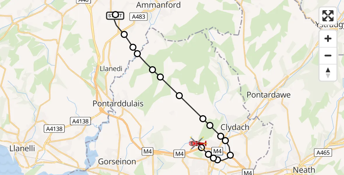
On Wednesday, 8 April 2026 at 20:44, a Air Ambulance Helicopter departed from Ammanford to Morriston Hospital Helipad. It was the Air Ambulance Helicopter with registration number G-WROL. The flight lasted 11 minutes. During that period, the aircraft travelled 12 miles at an average speed of 71 miles per hour at a maximum altitude of 1825 feet.
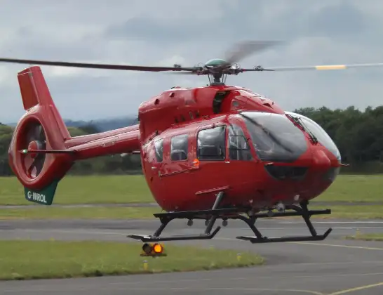
Helicopter: G-WROL
The helicopter G-WROL is used as a air ambulance helicopter. The main purpose of this aircraft is to transport a Mobile Medical Team to an incident as quickly as possible, enabling the trauma doctor to provide immediate first aid on site. The aircraft is flying this flight as Air Ambulance Helicopter.
Photo: James from Cheltenham, Gloucestershire
13 miles
1825 feet
71 mph
11 minutes
20:44
20:55

Route
Morriston Hospital Helipad, 20:55
Morriston Hospital Helipad20:53
Cwmrhydyceirw, Swansea20:52
Tregof, Swansea20:52
Llansamlet, Swansea20:52
Tregof, Swansea20:51
Ynystawe, Swansea20:50
Clydach, Swansea20:50
Ynystawe, Swansea20:50
Craig-cefn-parc, Swansea20:49
Felindre, Swansea20:48
Garnswllt, Swansea20:48
Pontarddulais, Swansea20:48
Garnswllt, Swansea20:47
Llanedi, Carmarthenshire20:47
Tycroes, Carmarthenshire20:46
Capel Hendre, Carmarthenshire20:44
Waterloo Road, Carmarthenshire20:44
Today
Flights Ammanford
Air Ambulance Helicopter to Dafen, Heol Aur29 Jun 16:27
Air Ambulance Helicopter to Ammanford, A47429 Jun 15:20
Police Helicopter to Ammanford, Heol Cwm Felin17 Jan 19:32
Helicopter flights on your website?
You can easily display helicopter flights on your own website. Use the embed code.
