Police Helicopter to Ammanford, Heol Cwm Felin
Saturday, 17 January 2026 | 19:32 | From Llantwit Major
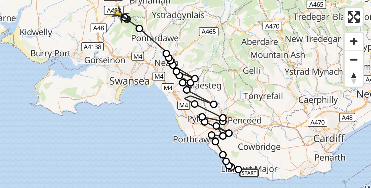
On Saturday, 17 January 2026 at 19:32, a Police Helicopter departed from Llantwit Major to Ammanford. It was the Police Helicopter with registration number G-NWOI. The flight lasted 14 minutes. During that period, the aircraft travelled 69 miles at an average speed of 295 miles per hour at a maximum altitude of 3900 feet.
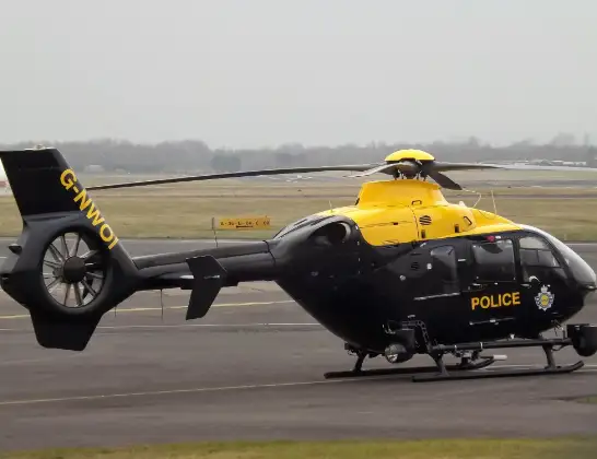
Helicopter: G-NWOI
The helicopter G-NWOI is used by the British police. The helicopter is deployed in pursuits, missing persons cases and other incidents where a helicopter provides added value.
Photo: James from Cheltenham
70 miles
3900 feet
295 mph
15 minutes
19:32
19:46

Route
Heol Cwm Felin, 19:46
Ammanford19:46
Betws19:46
Mawr19:45
Neath19:42
Cadoxton-juxta-Neath19:42
Tonna19:42
Neath19:41
Bryn19:41
Efail Fach19:41
Cwmavon19:41
Bryn19:41
Cwmafan19:40
Bryn19:40
Llangynwyd Lower19:39
Margam19:39
Sarn19:39
Pen-y-fai19:38
Kenfig Hill19:38
Cefn Cribwr19:37
Bridgend19:37
Bryntirion19:37
Bridgend19:37
Tythegston19:36
Ogmore19:36
St Brides Major19:35
Broughton19:34
Monknash19:34
Marcross19:34
St Donats19:33
Llantwit Major, 19:32
Live flights
Today
Flights Ammanford
Air Ambulance Helicopter to Dafen, Heol Aur29 Jun 16:27
Air Ambulance Helicopter to Ammanford, A47429 Jun 15:20
Police Helicopter to Ammanford, Heol Cwm Felin17 Jan 19:32
Helicopter flights on your website?
You can easily display helicopter flights on your own website. Use the embed code.
