Police Helicopter to Ynysybwl, Pontypridd
Monday, 6 April 2026 | 9:07 | From MOD St Athan
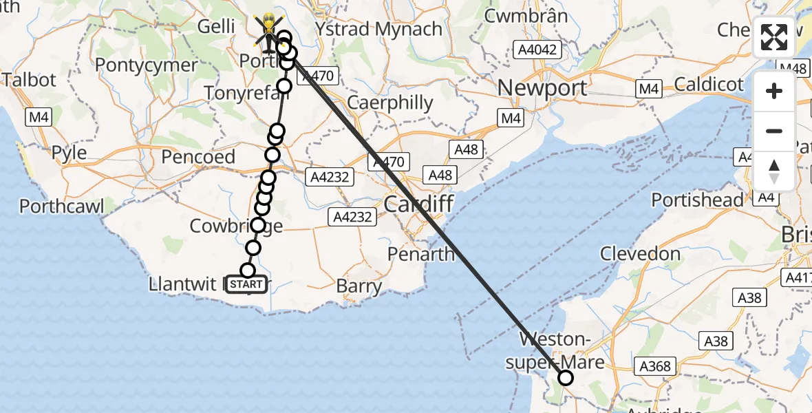
On Monday, 6 April 2026 at 9:07, a Police Helicopter departed from MOD St Athan to Ynysybwl. It was the Police Helicopter with registration number G-NWOI. The flight lasted 20 minutes. During that period, the aircraft travelled 75 miles at an average speed of 224 miles per hour at a maximum altitude of 1325 feet.
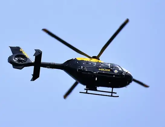
Helicopter: G-NWOI
The helicopter G-NWOI is used by the British police. The helicopter is deployed in pursuits, missing persons cases and other incidents where a helicopter provides added value.
Photo: Alec Wilson
76 miles
1325 feet
224 mph
21 minutes
09:07
09:27

Route
Pontypridd, Rhondda Cynon Taf09:27
Weston-super-Mare, North Somerset09:25
Pontypridd, Rhondda Cynon Taf09:16
Ynysybwl, Rhondda Cynon Taf09:16
Pontypridd, Rhondda Cynon Taf09:14
Ynysybwl, Rhondda Cynon Taf09:14
Pontypridd, Rhondda Cynon Taf09:13
Hopkinstown, Rhondda Cynon Taf09:13
Pontypridd, Rhondda Cynon Taf09:12
Llantrisant, Rhondda Cynon Taf09:11
Talbot Green, Rhondda Cynon Taf09:11
Pontyclun, Rhondda Cynon Taf09:10
Brynsadler, Rhondda Cynon Taf09:10
Welsh St. Donats, Vale of Glamorgan09:10
Ystradowen, Vale of Glamorgan09:09
Trerhingyll, Vale of Glamorgan09:09
Aberthin, Vale of Glamorgan09:09
St Hilary, Vale of Glamorgan09:08
St Mary Church, Vale of Glamorgan09:07
MOD St Athan, St Athan, Vale of Glamorgan09:07
Live flights
Police Helicopter on its way from MOD St Athan15 Jul 23:53
Police Helicopter on its way from Wrenthorpe15 Jul 23:36
Today
Police Helicopter to Glasgow, Renfrew Road15 Jul 23:45
Police Helicopter to Manchester Barton Aerodrome15 Jul 23:33
Police Helicopter to Renfrewshire15 Jul 23:32
Air Ambulance Helicopter to Southampton Airport15 Jul 23:30
Police Helicopter to Coopersale, Epping Road15 Jul 23:07
Police Helicopter to Largs, Lane 115 Jul 23:02
Flights Ynysybwl
Air Ambulance Helicopter to Dafen, Heol Aur8 Apr 12:23
Police Helicopter to Ynysybwl, Pontypridd6 Apr 09:07
Helicopter flights on your website?
You can easily display helicopter flights on your own website. Use the embed code.
