Air Ambulance Helicopter to Ynysybwl, Rock Terrace
Friday, 30 January 2026 | 11:05 | From Llangynwyd
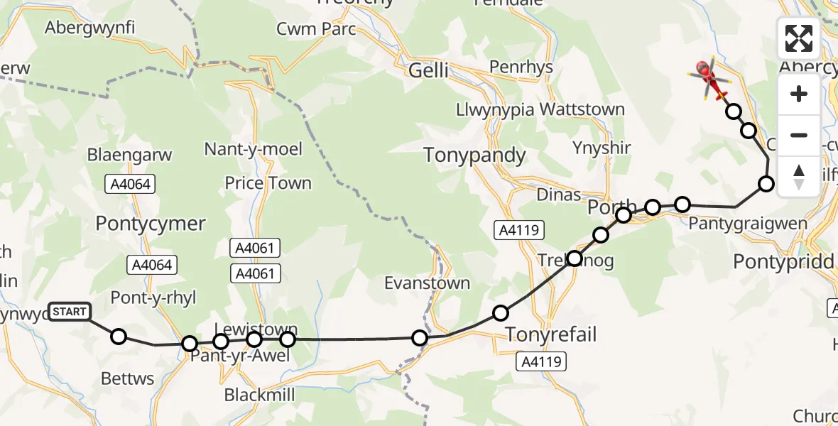
On Friday, 30 January 2026 at 11:05, a Air Ambulance Helicopter departed from Llangynwyd to Ynysybwl. It was the Air Ambulance Helicopter with registration number G-WROL. The flight lasted 7 minutes. During that period, the aircraft travelled 14 miles at an average speed of 122 miles per hour at a maximum altitude of 2050 feet.
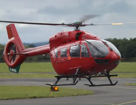
Helicopter: G-WROL
The helicopter G-WROL is used as a air ambulance helicopter. The main purpose of this aircraft is to transport a Mobile Medical Team to an incident as quickly as possible, enabling the trauma doctor to provide immediate first aid on site. The aircraft is flying this flight as Air Ambulance Helicopter.
Photo: James from Cheltenham, Gloucestershire
14 miles
2050 feet
122 mph
7 minutes
11:05
11:12

Route
Rock Terrace, 11:12
Ynysybwl11:11
Glyncoch11:11
Glyncoch, Pontypridd11:10
Pantygraigwen, Pontypridd11:10
Llwyncelyn11:09
Porth11:09
Cymmer11:09
Trebanog11:09
Tonyrefail11:08
Hendreforgan11:07
Ogmore Valley11:06
Lewistown11:06
Pant-yr-Awel11:06
Llangeinor11:05
Bettws11:05
Station Road, 11:05
Live flights
Police Helicopter on its way from Wrenthorpe15 Jul 23:36
Today
Police Helicopter to MOD St Athan15 Jul 23:53
Flights Ynysybwl
Air Ambulance Helicopter to Dafen, Heol Aur8 Apr 12:23
Police Helicopter to Ynysybwl, Pontypridd6 Apr 09:07
Flights Llangynwyd
Helicopter flights on your website?
You can easily display helicopter flights on your own website. Use the embed code.
