Air Ambulance Helicopter to Glasgow Airport
Sunday, 5 April 2026 | 17:05 | From Lochgilphead
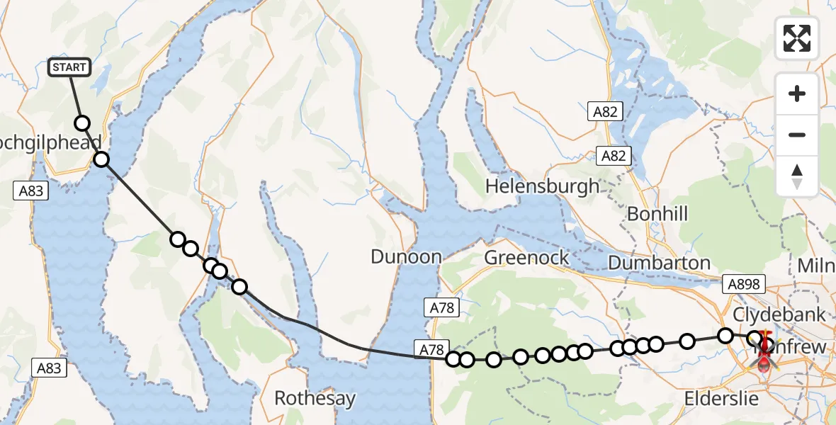
On Sunday, 5 April 2026 at 17:05, a Air Ambulance Helicopter departed from Lochgilphead to Glasgow Airport. It was the Air Ambulance Helicopter with registration number G-ISAS. The flight lasted 18 minutes. During that period, the aircraft travelled 46 miles at an average speed of 156 miles per hour at a maximum altitude of 2275 feet.

Helicopter: G-ISAS
The helicopter G-ISAS is used as a air ambulance helicopter. The main purpose of this aircraft is to transport a Mobile Medical Team to an incident as quickly as possible, enabling the trauma doctor to provide immediate first aid on site. The aircraft is flying this flight as Air Ambulance Helicopter.
Photo: Jonathan Payne
46 miles
2275 feet
156 mph
18 minutes
17:05
17:22

Route
Glasgow Airport, Glasgow17:22
Glasgow Airport, Glasgow17:22
Inchinnan, Renfrewshire17:21
Erskine, Renfrewshire17:20
Bishopton, Renfrewshire17:20
Houston, Renfrewshire17:19
Bridge of Weir, Renfrewshire17:19
Quarriers Village, Inverclyde17:19
Kilmacolm, Inverclyde17:18
Inverclyde, Inverclyde17:18
Port Glasgow, Inverclyde17:18
Inverclyde, Inverclyde17:17
Port Glasgow, Inverclyde17:17
Greenock, Inverclyde17:17
North Ayrshire, North Ayrshire17:16
Martin Glen, North Ayrshire17:16
Skelmorlie, North Ayrshire17:15
Inner Seas17:11
Colintraive, Argyll and Bute17:10
Buttock Point, Argyll and Bute17:10
Creag Maoile, Argyll and Bute17:09
Argyll and Bute, Argyll and Bute17:09
Inner Seas17:07
Port Ann, Argyll and Bute17:06
Lochgilphead, Argyll and Bute17:05
Live flights
Today
Police Helicopter to MOD St Athan15 Jul 23:53
Police Helicopter to East Ardsley, Stoney Lane15 Jul 23:36
Flights Lochgilphead
Air Ambulance Helicopter to Glasgow Airport5 Apr 17:05
Air Ambulance Helicopter to Lochgilphead5 Apr 15:03
Air Ambulance Helicopter to Lochgilphead24 Mar 19:26
Air Ambulance Helicopter to Lochgilphead25 Jan 21:36
Helicopter flights on your website?
You can easily display helicopter flights on your own website. Use the embed code.
