Air Ambulance Helicopter to Lochgilphead, The jink trail
Friday, 27 March 2026 | 19:50 | From Glasgow Airport
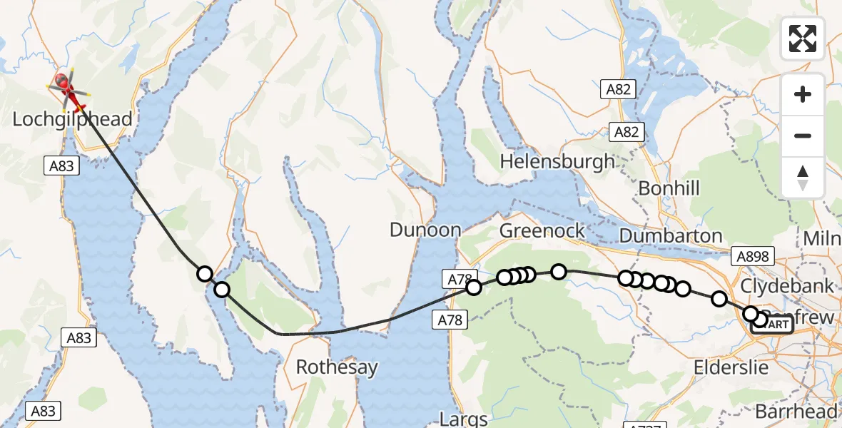
On Friday, 27 March 2026 at 19:50, a Air Ambulance Helicopter departed from Glasgow Airport to Lochgilphead. It was the Air Ambulance Helicopter with registration number G-ISAS. The flight lasted 28 minutes. During that period, the aircraft travelled 46 miles at an average speed of 101 miles per hour at a maximum altitude of 2000 feet.
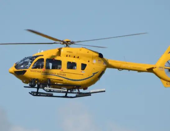
Helicopter: G-ISAS
The helicopter G-ISAS is used as a air ambulance helicopter. The main purpose of this aircraft is to transport a Mobile Medical Team to an incident as quickly as possible, enabling the trauma doctor to provide immediate first aid on site. The aircraft is flying this flight as Air Ambulance Helicopter.
Photo: Jonathan Payne
47 miles
2000 feet
101 mph
28 minutes
19:50
20:18

Route
The jink trail, Argyll and Bute20:18
Inner Seas20:11
Tighnabruaich, Argyll and Bute20:10
Inner Seas20:01
Inverkip, Inverclyde20:00
Inverclyde, Inverclyde20:00
Loch Thom20:00
Old Largs Road, Inverclyde19:59
Greenock, Inverclyde19:58
Port Glasgow, Inverclyde19:56
Finlaystone Road, Inverclyde19:56
Langbank, Renfrewshire19:55
Renfrewshire, Renfrewshire19:55
Langbank, Renfrewshire19:55
Houston, Renfrewshire19:54
Bishopton, Renfrewshire19:53
Erskine, Renfrewshire19:51
Renfrew, Renfrewshire19:51
Glasgow Airport, Glasgow19:50
Live flights
Today
Police Helicopter to MOD St Athan15 Jul 23:53
Police Helicopter to East Ardsley, Stoney Lane15 Jul 23:36
Flights Lochgilphead
Air Ambulance Helicopter to Glasgow Airport5 Apr 17:05
Air Ambulance Helicopter to Lochgilphead5 Apr 15:03
Air Ambulance Helicopter to Lochgilphead24 Mar 19:26
Air Ambulance Helicopter to Lochgilphead25 Jan 21:36
Helicopter flights on your website?
You can easily display helicopter flights on your own website. Use the embed code.
