Air Ambulance Helicopter to Glastonbury, The Mound
Friday, 3 April 2026 | 9:55 | From Henstridge Airfield
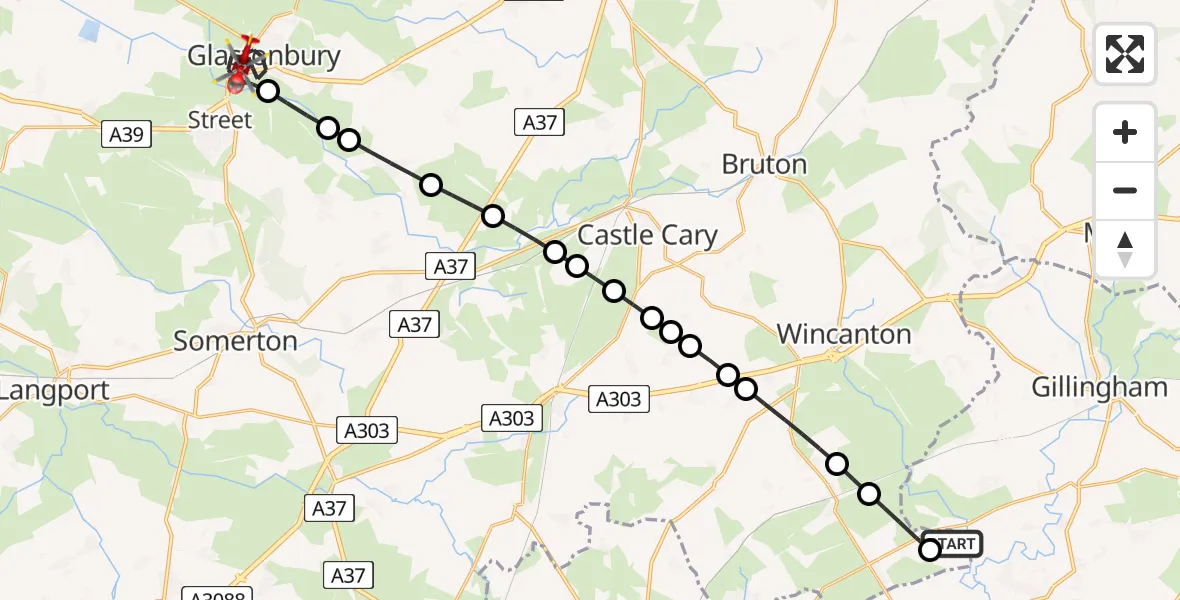
On Friday, 3 April 2026 at 9:55, a Air Ambulance Helicopter departed from Henstridge Airfield to Glastonbury. It was the Air Ambulance Helicopter with registration number G-DSAA. The flight lasted 18 minutes. During that period, the aircraft travelled 24 miles at an average speed of 80 miles per hour at a maximum altitude of 1025 feet.
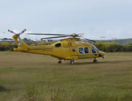
Helicopter: G-DSAA
The helicopter G-DSAA is used as a air ambulance helicopter. The main purpose of this aircraft is to transport a Mobile Medical Team to an incident as quickly as possible, enabling the trauma doctor to provide immediate first aid on site. The aircraft is flying this flight as Air Ambulance Helicopter.
Photo: Andrew Bone
24 miles
1025 feet
80 mph
18 minutes
09:55
10:13

Route
The Mound, Somerset10:13
Glastonbury, Somerset10:08
Butleigh, Somerset10:07
Glastonbury, Somerset10:07
Baltonsborough, Somerset10:06
Hornblotton Green, Somerset10:05
Alford, Somerset10:05
North Barrow, Somerset10:04
Castle Cary, Somerset10:04
Galhampton, Somerset10:03
Yarlington, Somerset10:03
Woolston, Somerset10:03
Blackford, Somerset10:02
Holton, Somerset10:02
South Cheriton, Somerset10:01
Templecombe, Somerset10:00
Henstridge, Somerset09:59
Henstridge Airfield, Templecombe, Somerset09:59
Henstridge Airfield, Templecombe, Somerset09:55
Live flights
Today
Flights Glastonbury
Air Ambulance Helicopter to Glastonbury18 Apr 00:07
Air Ambulance Helicopter to Henstridge Airfield28 Mar 13:24
Air Ambulance Helicopter to Glastonbury28 Mar 11:34
Helicopter flights on your website?
You can easily display helicopter flights on your own website. Use the embed code.
