Police Helicopter to Abergele, Station Approach
Friday, 3 April 2026 | 3:24 | From Hawarden Airport
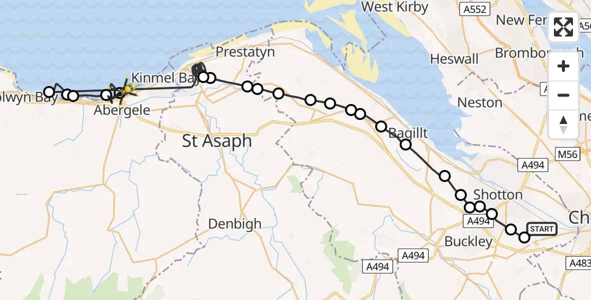
On Friday, 3 April 2026 at 3:24, a Police Helicopter departed from Hawarden Airport to Abergele. It was the Police Helicopter with registration number G-POLC. The flight lasted 36 minutes. During that period, the aircraft travelled 47 miles at an average speed of 80 miles per hour at a maximum altitude of 2100 feet.
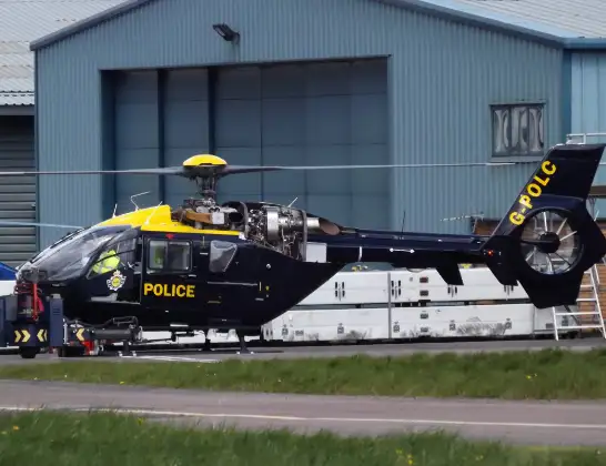
Helicopter: G-POLC
The helicopter G-POLC is used by the British police. The helicopter is deployed in pursuits, missing persons cases and other incidents where a helicopter provides added value.
Photo: James
48 miles
2100 feet
80 mph
36 minutes
03:24
04:00

Route
Station Approach, Conwy04:00
Abergele, Conwy03:59
Pensarn, Conwy03:58
Llanddulas, Conwy03:56
Llysfaen, Conwy03:56
Old Colwyn, Conwy03:55
Rhyl, Denbighshire03:37
St Asaph, Denbighshire03:37
Dyserth, Denbighshire03:35
Gwaenysgor, Flintshire03:35
Trelawnyd, Flintshire03:34
Lloc, Flintshire03:33
Whitford, Flintshire03:32
Carmel, Flintshire03:32
Holway, Flintshire03:31
Holywell, Flintshire03:31
Bagillt, Flintshire03:30
Flint, Flintshire03:28
Northop Hall, Flintshire03:27
Connah's Quay, Flintshire03:27
Ewloe Green, Flintshire03:27
Ewloe, Flintshire03:26
Hawarden, Flintshire03:25
Broughton, Flintshire03:25
Hawarden Airport, Broughton03:24
Live flights
Today
Flights Abergele
Police Helicopter to Hawarden Airport31 Mar 23:27
Police Helicopter to Abergele, Lôn Dderwen31 Mar 22:59
Air Ambulance Helicopter to Caernarfon Airport25 Jan 13:21
Helicopter flights on your website?
You can easily display helicopter flights on your own website. Use the embed code.
