Air Ambulance Helicopter to Caernarfon Airport
Sunday, 25 January 2026 | 13:21 | From Abergele
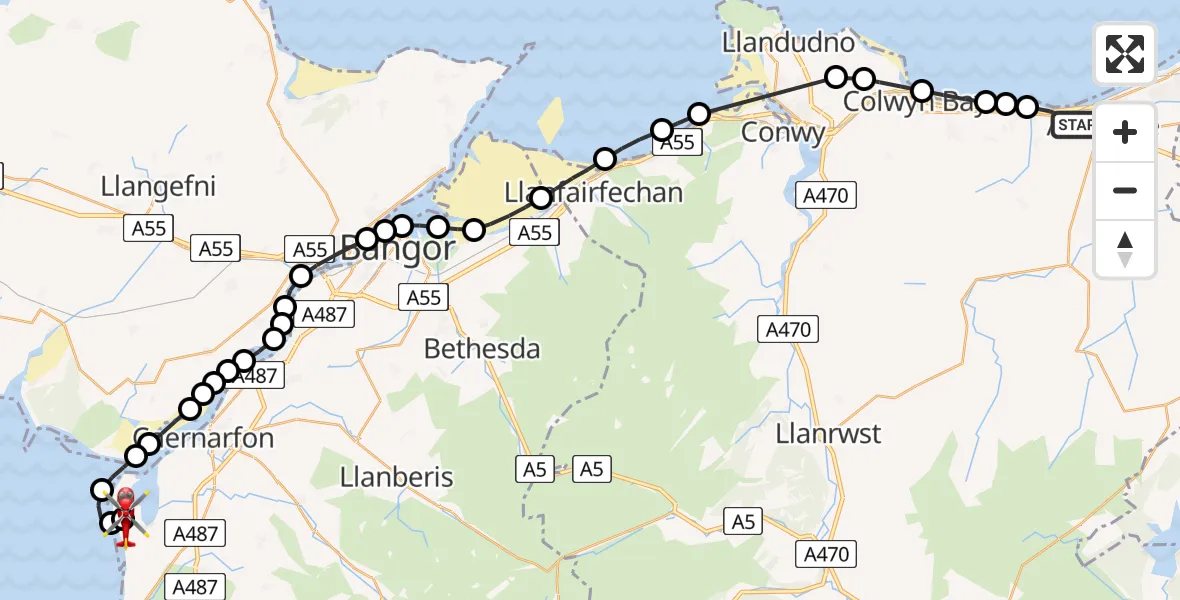
On Sunday, 25 January 2026 at 13:21, a Air Ambulance Helicopter departed from Abergele to Caernarfon Airport. It was the Air Ambulance Helicopter with registration number G-LOYW. The flight lasted 17 minutes. During that period, the aircraft travelled 38 miles at an average speed of 131 miles per hour at a maximum altitude of 1625 feet.
Helicopter: G-LOYW
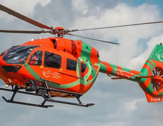
The helicopter G-LOYW is used as a air ambulance helicopter. The main purpose of this aircraft is to transport a Mobile Medical Team to an incident as quickly as possible, enabling the trauma doctor to provide immediate first aid on site. The aircraft is flying this flight as Air Ambulance Helicopter.
Photo: Sarahpurpleface
38 miles
1625 feet
131 mph
18 minutes
13:21
13:38

Route
Caernarfon Airport, Caernarfon13:38
Caernarfon Airport, Caernarfon13:38
Caernarfon Airport, Caernarfon13:36
Llanfaglan13:36
Dinas Dinlle13:35
Pen-Lôn13:34
Dwyran13:34
Rhosyr13:33
Dwyran13:33
Brynsiencyn13:33
Y Felinheli13:33
Brynsiencyn13:32
Llanddaniel Fab13:32
Y Felinheli13:32
Brynsiencyn13:31
Llanfairpwllgwyngyll13:31
Porthaethwy / Menai Bridge13:30
Bangor13:30
Beaumaris13:29
Llandygai13:29
Llanllechid13:28
Aber13:27
Llanfairfechan13:26
Penmaenmawr13:26
Dwygyfylchi13:25
Bryn Pydew, Llandudno Junction13:23
Mochdre13:23
Colwyn Bay13:22
Old Colwyn13:22
Llysfaen13:21
Llanddulas13:21
Ffordd Tan y Gopa, 13:21
Live flights
Today
Flights Abergele
Police Helicopter to Hawarden Airport31 Mar 23:27
Police Helicopter to Abergele, Lôn Dderwen31 Mar 22:59
Air Ambulance Helicopter to Caernarfon Airport25 Jan 13:21
Helicopter flights on your website?
You can easily display helicopter flights on your own website. Use the embed code.
