Air Ambulance Helicopter to Wreningham, Wymondham Road
Thursday, 2 April 2026 | 15:17 | From Norwich Airport

On Thursday, 2 April 2026 at 15:17, a Air Ambulance Helicopter departed from Norwich Airport to Wreningham. It was the Air Ambulance Helicopter with registration number G-HEMC. The flight lasted 20 minutes. During that period, the aircraft travelled 15 miles at an average speed of 45 miles per hour at a maximum altitude of 1025 feet.
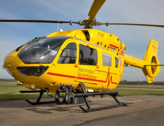
Helicopter: G-HEMC
The helicopter G-HEMC is used as a air ambulance helicopter. The main purpose of this aircraft is to transport a Mobile Medical Team to an incident as quickly as possible, enabling the trauma doctor to provide immediate first aid on site. The aircraft is flying this flight as Air Ambulance Helicopter.
Photo: Jsmauger
15 miles
1025 feet
45 mph
21 minutes
15:17
15:37

Route
Wymondham Road, Norfolk15:37
Wreningham, Norfolk15:34
Fir Grove Airstrip, Wreningham15:33
Wreningham, Norfolk15:33
Wymondham, Norfolk15:32
South Norfolk, Norfolk15:32
Ketteringham, Norfolk15:31
Hethersett, Norfolk15:31
Colney, Norfolk15:30
Norwich, Norfolk15:30
Costessey, Norfolk15:29
Drayton, Norfolk15:29
Holt Road, Norfolk15:28
Horsham St Faith, Norfolk15:28
Norwich Airport, Norwich, Norfolk15:24
Norwich Airport, Norwich, Norfolk15:17
Live flights
Today
Police Helicopter to Manchester Barton Aerodrome13 Jul 23:56
Police Helicopter to Bournemouth Airport13 Jul 23:55
Air Ambulance Helicopter to Cardiff Heliport13 Jul 23:38
Police Helicopter to Harborough, Sulby Road13 Jul 23:36
Police Helicopter to Birmingham Airport13 Jul 23:21
Flights Wreningham
Air Ambulance Helicopter to Norwich Airport2 Apr 16:27
Helicopter flights on your website?
You can easily display helicopter flights on your own website. Use the embed code.
