Air Ambulance Helicopter to Byfield, Bell Lane
Monday, 30 March 2026 | 12:43 | From Coventry Airport
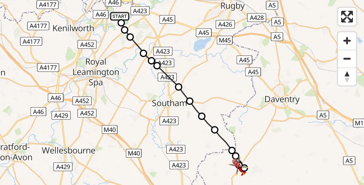
On Monday, 30 March 2026 at 12:43, a Air Ambulance Helicopter departed from Coventry Airport to Byfield. It was the Air Ambulance Helicopter with registration number G-WNAS. The flight lasted 7 minutes. During that period, the aircraft travelled 19 miles at an average speed of 152 miles per hour at a maximum altitude of 1050 feet.
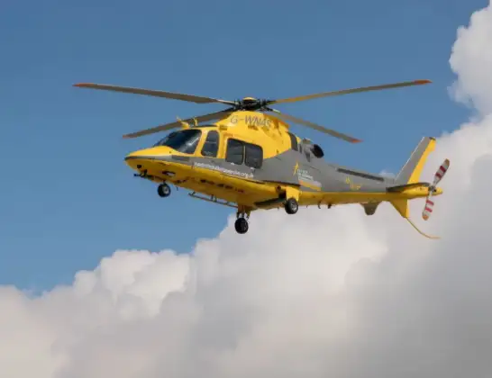
Helicopter: G-WNAS
The helicopter G-WNAS is used as an ambulance helicopter. The helicopter is equipped with a stretcher for transporting patients. The helicopter is often used to transport to hospitals.
Photo: Tony Melony
19 miles
1050 feet
152 mph
8 minutes
12:43
12:51

Route
Bell Lane, West Northamptonshire12:51
Daventry, West Northamptonshire12:50
Byfield, West Northamptonshire12:49
Daventry, West Northamptonshire12:49
Byfield, West Northamptonshire12:48
Priors Marston, West Northamptonshire12:48
Priors Marston, Warwickshire12:48
Stratford-on-Avon, Warwickshire12:47
Napton on the Hill, Warwickshire12:46
Stockton CP, Warwickshire12:46
Long Itchington, Warwickshire12:45
Stratford-on-Avon, Warwickshire12:45
Hunningham, Warwickshire12:45
Wappenbury, Warwickshire12:44
Bubbenhall, Warwickshire12:44
Stoneleigh, Warwickshire12:43
Samaritan Way, West Midlands - Warwickshire12:43
Live flights
Today
Flights Byfield
Air Ambulance Helicopter to Coventry Airport30 Mar 13:22
Air Ambulance Helicopter to Byfield, Bell Lane30 Mar 12:43
Helicopter flights on your website?
You can easily display helicopter flights on your own website. Use the embed code.
