Air Ambulance Helicopter to Penkridge, Pinfold Lane
Monday, 30 March 2026 | 11:07 | From RAF Cosford
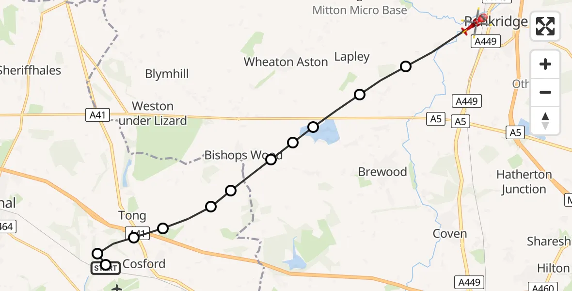
On Monday, 30 March 2026 at 11:07, a Air Ambulance Helicopter departed from RAF Cosford to Penkridge. It was the Air Ambulance Helicopter with registration number G-RMAA. The flight lasted 5 minutes. During that period, the aircraft travelled 10 miles at an average speed of 110 miles per hour at a maximum altitude of 975 feet.
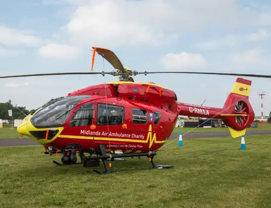
Helicopter: G-RMAA
The helicopter G-RMAA is used as a air ambulance helicopter. The main purpose of this aircraft is to transport a Mobile Medical Team to an incident as quickly as possible, enabling the trauma doctor to provide immediate first aid on site. The aircraft is flying this flight as Air Ambulance Helicopter.
Photo: Steve Lynes
10 miles
975 feet
110 mph
6 minutes
11:07
11:12

Route
Pinfold Lane, West Midlands - Staffordshire11:12
Penkridge, Staffordshire11:12
Lapley, Staffordshire11:11
Bishops Wood, Staffordshire11:11
South Staffordshire, Staffordshire11:10
Bishops Wood, Staffordshire11:10
South Staffordshire, Shropshire11:10
Cosford, Shropshire11:09
Tong, Shropshire11:09
Cosford, Shropshire11:09
Neachley Lane, West Midlands - Shropshire11:08
Tong, Shropshire11:08
Cosford, Shropshire11:08
RAF Cosford, Cosford11:07
Live flights
Today
Flights Penkridge
Police Helicopter to Birmingham Airport4 Apr 01:28
Police Helicopter to Prees Lower Heath30 Mar 12:49
Police Helicopter to Penkridge, Church Road30 Mar 12:44
Police Helicopter to Birmingham, Coventry Road28 Jan 21:37
Helicopter flights on your website?
You can easily display helicopter flights on your own website. Use the embed code.
