Police Helicopter to Birmingham, Coventry Road
Wednesday, 28 January 2026 | 21:37 | From Penkridge
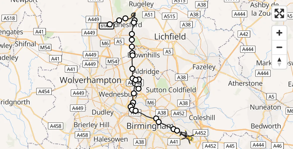
On Wednesday, 28 January 2026 at 21:37, a Police Helicopter departed from Penkridge to Birmingham. It was the Police Helicopter with registration number G-POLJ. The flight lasted 25 minutes. During that period, the aircraft travelled 43 miles at an average speed of 102 miles per hour at a maximum altitude of 2300 feet.
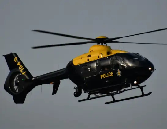
Helicopter: G-POLJ
The helicopter G-POLJ is used by the British police. The helicopter is deployed in pursuits, missing persons cases and other incidents where a helicopter provides added value.
Photo: Alec Wilson
43 miles
2300 feet
102 mph
26 minutes
21:37
22:03

Route
Coventry Road, West Midlands22:03
Garretts Green, Birmingham22:01
Hay Mills, Birmingham22:01
Saltley, Birmingham22:00
Nechells, Birmingham22:00
Birmingham, West Midlands21:58
Smethwick, Sandwell21:58
West Bromwich, Sandwell21:57
Smethwick, Sandwell21:57
West Bromwich, Sandwell21:52
Sandwell, West Midlands21:51
Walsall, West Midlands21:50
Aldridge, West Midlands21:50
Great Barr, Walsall21:49
Walsall, West Midlands21:48
Rushall, Walsall21:47
Pelsall, Walsall21:46
Pelsall, Cannock Chase21:46
Cannock Chase21:46
Norton Canes, Cannock Chase21:45
Heath Hayes, Cannock Chase21:45
Wimblebury, Cannock Chase21:44
Prospect Village, Cannock Chase21:43
Cannock Chase21:39
Hednesford, Cannock Chase21:38
Huntington, South Staffordshire21:38
Cannock Road, South Staffordshire21:37
Live flights
Today
Flights Birmingham
Police Helicopter to Birmingham, Centro Way2 Apr 03:18
Police Helicopter to Birmingham Airport1 Apr 03:03
Police Helicopter to Birmingham, Centro Way31 Mar 20:17
Police Helicopter to Birmingham Airport31 Mar 15:13
Police Helicopter to Birmingham, Centro Way31 Mar 01:32
Police Helicopter to Birmingham Airport30 Mar 20:16
Police Helicopter to Birmingham, Centro Way29 Mar 20:42
Police Helicopter to Birmingham, Terminal Road28 Mar 15:25
Police Helicopter to Birmingham, Centro Way28 Mar 11:03
Flights Penkridge
Police Helicopter to Birmingham Airport4 Apr 01:28
Police Helicopter to Prees Lower Heath30 Mar 12:49
Police Helicopter to Penkridge, Church Road30 Mar 12:44
Police Helicopter to Birmingham, Coventry Road28 Jan 21:37
Helicopter flights on your website?
You can easily display helicopter flights on your own website. Use the embed code.
