Air Ambulance Helicopter to Daventry, Eastern Way
Saturday, 28 March 2026 | 16:24 | From Coventry Airport
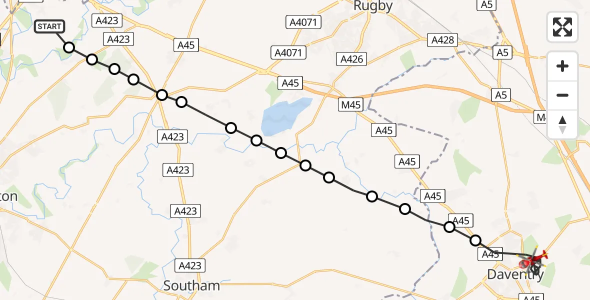
On Saturday, 28 March 2026 at 16:24, a Air Ambulance Helicopter departed from Coventry Airport to Daventry. It was the Air Ambulance Helicopter with registration number G-WNAS. The flight lasted 11 minutes. During that period, the aircraft travelled 19 miles at an average speed of 103 miles per hour at a maximum altitude of 1100 feet.
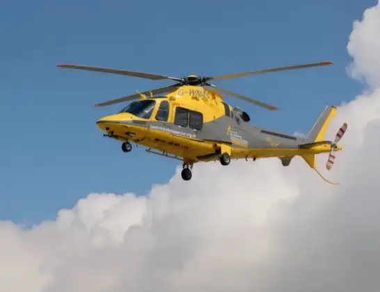
Helicopter: G-WNAS
The helicopter G-WNAS is used as an ambulance helicopter. The helicopter is equipped with a stretcher for transporting patients. The helicopter is often used to transport to hospitals.
Photo: Tony Melony
20 miles
1100 feet
103 mph
12 minutes
16:24
16:35

Route
Eastern Way, West Northamptonshire16:35
Daventry, West Northamptonshire16:28
Braunston, West Northamptonshire16:28
Rugby, Warwickshire16:28
Sawbridge, Warwickshire16:27
Grandborough CP, Warwickshire16:27
Leamington Hastings CP, Warwickshire16:27
Thurlaston CP, Warwickshire16:26
Draycote, Warwickshire16:26
Bourton on Dunsmore, Warwickshire16:26
Frankton CP, Warwickshire16:25
Princethorpe CP, Warwickshire16:25
Stretton on Dunsmore CP, Warwickshire16:25
Wappenbury, Warwickshire16:25
Bubbenhall, Warwickshire16:24
Baginton, Warwickshire16:24
Coventry Airport, Coventry, West Midlands16:24
Today
Flights Daventry
Air Ambulance Helicopter to Coventry Airport28 Mar 17:43
Air Ambulance Helicopter to Coventry Airport19 Mar 16:01
Air Ambulance Helicopter to Daventry, Taper Way19 Mar 15:42
Air Ambulance Helicopter to Coventry Airport13 Mar 13:22
Helicopter flights on your website?
You can easily display helicopter flights on your own website. Use the embed code.
