Air Ambulance Helicopter to Crook, Wheatbottom
Thursday, 26 March 2026 | 16:10 | From Longnewton
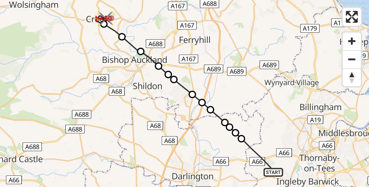
On Thursday, 26 March 2026 at 16:10, a Air Ambulance Helicopter departed from Longnewton to Crook. It was the Air Ambulance Helicopter with registration number G-NHAE. The flight lasted 9 minutes. During that period, the aircraft travelled 20 miles at an average speed of 132 miles per hour at a maximum altitude of 1275 feet.
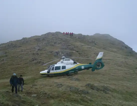
Helicopter: G-NHAE
The helicopter G-NHAE is used as a air ambulance helicopter. The main purpose of this aircraft is to transport a Mobile Medical Team to an incident as quickly as possible, enabling the trauma doctor to provide immediate first aid on site. The aircraft is flying this flight as Air Ambulance Helicopter.
Photo: Michael Earnshaw
21 miles
1275 feet
132 mph
10 minutes
16:10
16:19

Route
Wheatbottom, North East16:19
Crook, North East16:18
New Hunwick, North East16:17
Bishop Auckland, North East16:16
Coundon, North East16:16
Middridge, Newton Aycliffe16:15
Middridge, North East16:15
Newton Aycliffe, North East16:14
Great Aycliffe, North East16:14
Mordon, North East16:13
Great Stainton, Tees Valley16:13
Sadberge, Tees Valley16:13
Little Stainton, Tees Valley16:12
East and West Newbiggin, Tees Valley16:12
Longnewton Lane, Tees Valley16:10
Today
Flights Crook
Air Ambulance Helicopter to Crook, Wheatbottom26 Mar 16:10
Air Ambulance Helicopter to Crook, Low Jobs Hill23 Feb 14:28
Flights Longnewton
Helicopter flights on your website?
You can easily display helicopter flights on your own website. Use the embed code.
