Air Ambulance Helicopter to Coventry Airport
Saturday, 21 March 2026 | 12:55 | From Rushden
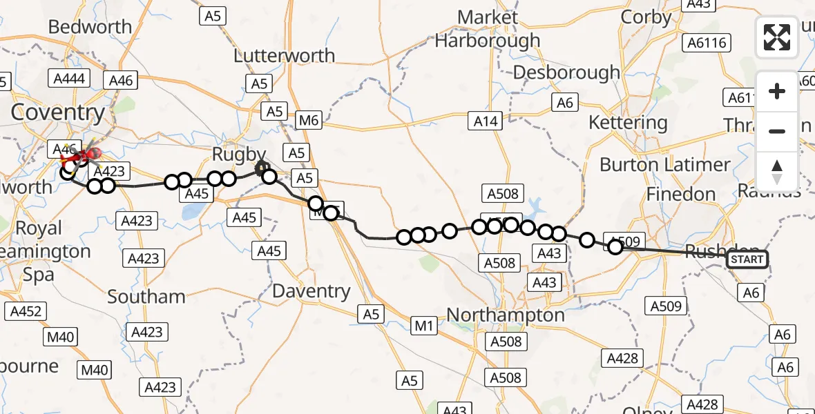
On Saturday, 21 March 2026 at 12:55, a Air Ambulance Helicopter departed from Rushden to Coventry Airport. It was the Air Ambulance Helicopter with registration number G-WNAS. The flight lasted 19 minutes. During that period, the aircraft travelled 49 miles at an average speed of 157 miles per hour at a maximum altitude of 1475 feet.
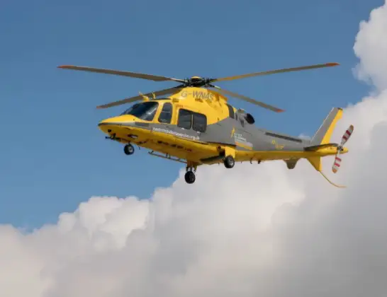
Helicopter: G-WNAS
The helicopter G-WNAS is used as an ambulance helicopter. The helicopter is equipped with a stretcher for transporting patients. The helicopter is often used to transport to hospitals.
Photo: Tony Melony
49 miles
1475 feet
157 mph
19 minutes
12:55
13:13

Route
Coventry Airport, Coventry, West Midlands13:13
Coventry Airport, Coventry, West Midlands13:13
Baginton, Warwick13:13
Stoneleigh, Warwick13:13
Bubbenhall, Warwick13:12
Rugby, Rugby13:11
Stretton on Dunsmore CP, Rugby13:10
Rugby, Rugby13:10
Dunchurch, Rugby13:09
Bilton, Rugby13:09
Rugby, Rugby13:03
Kilsby, Kilsby13:02
Watford, Watford13:02
Long Buckby, Long Buckby13:00
East Haddon, East Haddon13:00
Holdenby, Holdenby12:59
Teeton, Teeton12:59
Spratton, Spratton12:58
Brixworth, Brixworth12:58
Pitsford Water12:58
Moulton, Moulton12:57
Holcot, Holcot12:57
Overstone, Overstone12:56
Sywell, Sywell12:56
Mears Ashby, Mears Ashby12:55
Rushden, Rushden12:55
Live flights
Today
Flights Rushden
Air Ambulance Helicopter to Coventry Airport21 Mar 12:55
Air Ambulance Helicopter to Rushden, Quorn Road29 Jan 14:06
Helicopter flights on your website?
You can easily display helicopter flights on your own website. Use the embed code.
