Police Helicopter to MOD St Athan
Thursday, 19 March 2026 | 19:15 | From Ynysmeudwy
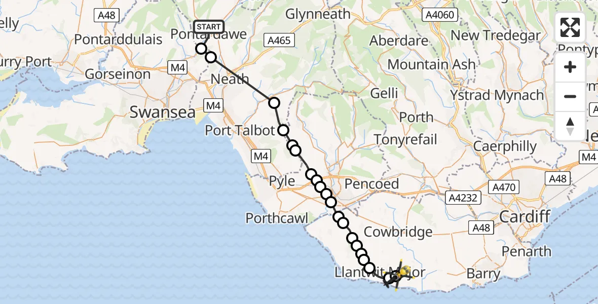
On Thursday, 19 March 2026 at 19:15, a Police Helicopter departed from Ynysmeudwy to MOD St Athan. It was the Police Helicopter with registration number G-NWOI. The flight lasted 14 minutes. During that period, the aircraft travelled 31 miles at an average speed of 136 miles per hour at a maximum altitude of 1800 feet.
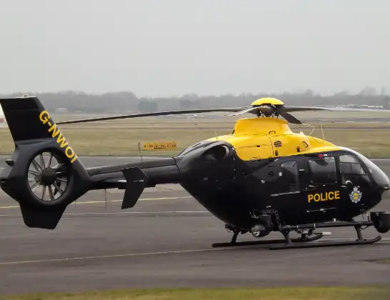
Helicopter: G-NWOI
The helicopter G-NWOI is used by the British police. The helicopter is deployed in pursuits, missing persons cases and other incidents where a helicopter provides added value.
Photo: James from Cheltenham
32 miles
1800 feet
136 mph
14 minutes
19:15
19:29

Route
MOD St Athan, St Athan, Vale of Glamorgan19:29
MOD St Athan, St Athan, Vale of Glamorgan19:28
Boverton, Boverton19:28
Llantwit Major, Llantwit Major19:26
St Donats, St Donats19:26
Llantwit Major, Llantwit Major19:26
Wick, Wick19:25
St. Brides Major, St. Brides Major19:25
Ewenny, Ewenny19:24
Bridgend, Bridgend19:24
Bridgend, Bridgend19:23
Cefn Glas, Cefn Glas19:23
Pen-y-fai, Pen-y-fai19:23
Aberkenfig, Aberkenfig19:22
Cefn Cribwr, Cefn Cribwr19:22
Llangynwyd Lower, Llangynwyd Lower19:21
Llangynwyd, Llangynwyd19:21
Bryn, Bryn19:20
Bryn, Bryn19:19
Dyffryn Clydach, Dyffryn Clydach19:17
Clydach, Clydach19:16
Llanguicke Road, Pontardawe19:15
Today
Flights Ynysmeudwy
Police Helicopter to MOD St Athan19 Mar 19:15
Helicopter flights on your website?
You can easily display helicopter flights on your own website. Use the embed code.
