Coastguard Helicopter to Mealabost
Thursday, 19 March 2026 | 19:15 | From Edinbane - An t-Aodann Bàn
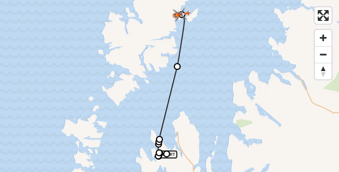
On Thursday, 19 March 2026 at 19:15, a Coastguard Helicopter departed from Edinbane - An t-Aodann Bàn to Mealabost. It was the Coastguard Helicopter with registration number G-MCGZ. The flight lasted 57 minutes. During that period, the aircraft travelled 71 miles at an average speed of 74 miles per hour at a maximum altitude of 1575 feet.
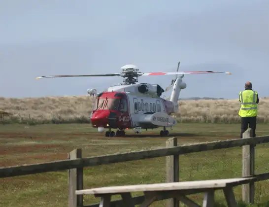
Helicopter: G-MCGZ
The helicopter G-MCGZ is used by the British Coastguard. The helicopter is deployed in search and rescue operations at sea, rescue operations involving ships or drilling platforms, patrols to prevent smuggling or piracy, environmental monitoring and disaster relief support.
Photo: Andrewrabbott
71 miles
1575 feet
74 mph
58 minutes
19:15
20:12

Route
Mealabost, Mealabost20:12
Mealabost, Mealabost20:12
Inner Seas20:04
Geary - An Geàrraidh, Geary - An Geàrraidh19:55
Lusta, Lusta19:54
Stein - Steinn, Stein - Steinn19:54
Lusta, Lusta19:52
Dunvegan - Dùn Bheagain, Dunvegan - Dùn Bheagain19:47
Lusta, Lusta19:32
Dunvegan - Dùn Bheagain, Dunvegan - Dùn Bheagain19:32
Lusta, Lusta19:21
Greshornish - Grìsinis, Greshornish - Grìsinis19:19
Edinbane - An t-Aodann Bàn, Edinbane - An t-Aodann Bàn19:18
19:15
Live flights
Police Helicopter on its way from MOD St Athan13 Apr 22:47
Police Helicopter on its way from South Nutfield13 Apr 22:47
Police Helicopter on its way from East Ardsley13 Apr 22:17
Today
Police Helicopter to Harborough, Sulby Road13 Apr 22:12
Coastguard Helicopter to Solent Airport13 Apr 22:07
Air Ambulance Aircraft to Glasgow Airport13 Apr 22:03
Air Ambulance Helicopter to Henstridge Airfield13 Apr 21:52
Police Helicopter to North Weald Airfield13 Apr 21:46
Coastguard Helicopter to Humberside Airport13 Apr 21:45
Police Helicopter to Tandridge, Moats Lane13 Apr 21:43
Coastguard Helicopter to Seaford, Southdown Road13 Apr 21:43
Flights Mealabost
Coastguard Helicopter to Mealabost13 Apr 15:58
Coastguard Helicopter to Mealabost12 Apr 22:13
Coastguard Helicopter to Mealabost12 Apr 16:37
Coastguard Helicopter to Inner Seas10 Apr 19:58
Coastguard Helicopter to Mealabost8 Apr 10:49
Coastguard Helicopter to Inner Seas6 Apr 12:39
Coastguard Helicopter to Mealabost31 Mar 02:21
Coastguard Helicopter to Mealabost30 Mar 20:33
Coastguard Helicopter to Mealabost30 Mar 20:29
Coastguard Helicopter to Mealabost28 Mar 21:05
Helicopter flights on your website?
You can easily display helicopter flights on your own website. Use the embed code.
