Air Ambulance Helicopter to Wellingborough, Goldsmith Road
Sunday, 15 March 2026 | 18:01 | From Lower Shuckburgh
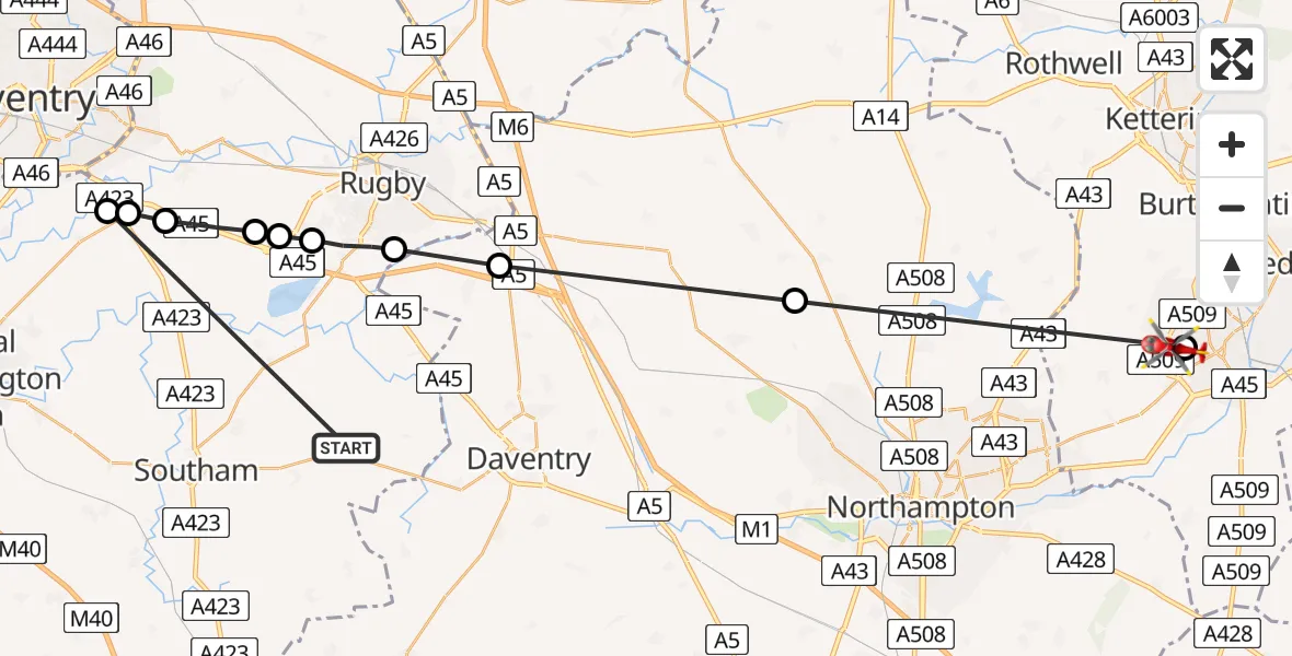
On Sunday, 15 March 2026 at 18:01, a Air Ambulance Helicopter departed from Lower Shuckburgh to Wellingborough. It was the Air Ambulance Helicopter with registration number G-WNAS. The flight lasted 11 minutes. During that period, the aircraft travelled 41 miles at an average speed of 227 miles per hour at a maximum altitude of 1800 feet.
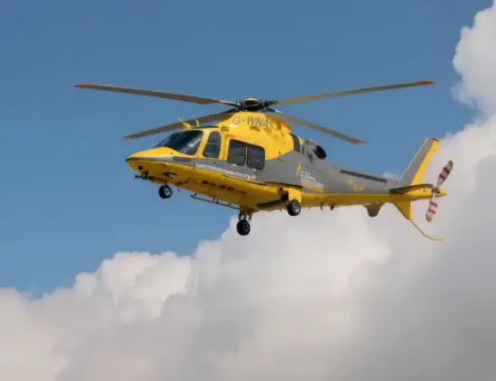
Helicopter: G-WNAS
The helicopter G-WNAS is used as an ambulance helicopter. The helicopter is equipped with a stretcher for transporting patients. The helicopter is often used to transport to hospitals.
Photo: Tony Melony
42 miles
1800 feet
227 mph
11 minutes
18:01
18:12

Route
Goldsmith Road, Wellingborough18:12
Wellingborough, Wellingborough18:11
Teeton, Teeton18:08
Kilsby, Kilsby18:05
Rugby, Rugby18:04
Dunchurch, Rugby18:03
Rugby, Rugby18:03
RAF Church Lawford, Coventry, Warwickshire18:03
Stretton on Dunsmore CP, Rugby18:02
Ryton-on-Dunsmore, Rugby18:02
Rugby, Rugby18:01
Bridge 105, Stratford-on-Avon18:01
Live flights
Today
Flights Wellingborough
Air Ambulance Helicopter to Coventry Airport15 Jun 16:12
Air Ambulance Helicopter to Coventry Airport24 May 13:28
Police Helicopter to Birmingham Airport12 May 16:08
Police Helicopter to Harborough, Sulby Road3 May 16:09
Helicopter flights on your website?
You can easily display helicopter flights on your own website. Use the embed code.
