Air Ambulance Helicopter to Durham, Flass Vale
Thursday, 12 March 2026 | 16:53 | From Egglescliffe
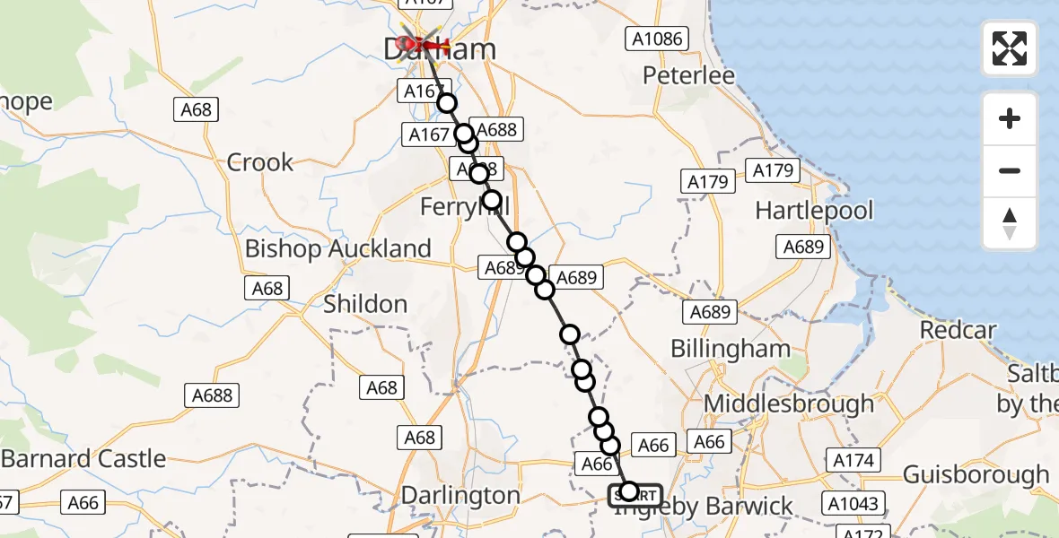
On Thursday, 12 March 2026 at 16:53, a Air Ambulance Helicopter departed from Egglescliffe to Durham. It was the Air Ambulance Helicopter with registration number G-NHAE. The flight lasted 8 minutes. During that period, the aircraft travelled 20 miles at an average speed of 142 miles per hour at a maximum altitude of 1875 feet.
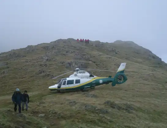
Helicopter: G-NHAE
The helicopter G-NHAE is used as a air ambulance helicopter. The main purpose of this aircraft is to transport a Mobile Medical Team to an incident as quickly as possible, enabling the trauma doctor to provide immediate first aid on site. The aircraft is flying this flight as Air Ambulance Helicopter.
Photo: Michael Earnshaw
20 miles
1875 feet
142 mph
9 minutes
16:53
17:01

Route
Flass Vale, North East17:01
Durham, North East17:00
Hett, North East16:59
Ferryhill, North East16:59
West Cornforth, Ferryhill16:59
West Cornforth, North East16:58
Bishop Middleham, North East16:58
Bradbury, North East16:57
Sedgefield, North East16:57
Stockton-on-Tees, North East16:57
Sedgefield, North East16:56
Stillington, Tees Valley16:55
Stockton-on-Tees, Tees Valley16:55
Redmarshall, Tees Valley16:55
Longnewton, Tees Valley16:54
Elton, Tees Valley16:54
Longnewton Lane, Tees Valley16:54
Longnewton, Tees Valley16:53
Egglescliffe, Tees Valley16:53
Live flights
Today
Flights Durham
Police Helicopter to Durham, South Street6 Jun 08:28
Police Helicopter to Durham, B653229 Apr 09:52
Air Ambulance Helicopter to Egglescliffe27 Apr 18:13
Flights Egglescliffe
Air Ambulance Helicopter to Egglescliffe, A6713 Jul 15:39
Air Ambulance Helicopter to Egglescliffe, A6713 Jul 13:57
Air Ambulance Helicopter to Egglescliffe10 Jul 15:36
Helicopter flights on your website?
You can easily display helicopter flights on your own website. Use the embed code.
