Air Ambulance Helicopter to Edenhall
Wednesday, 4 March 2026 | 12:14 | From Calthwaite
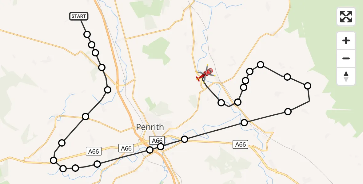
On Wednesday, 4 March 2026 at 12:14, a Air Ambulance Helicopter departed from Calthwaite to Edenhall. It was the Air Ambulance Helicopter with registration number G-NHAE. The flight lasted 12 minutes. During that period, the aircraft travelled 30 miles at an average speed of 148 miles per hour at a maximum altitude of 1750 feet.
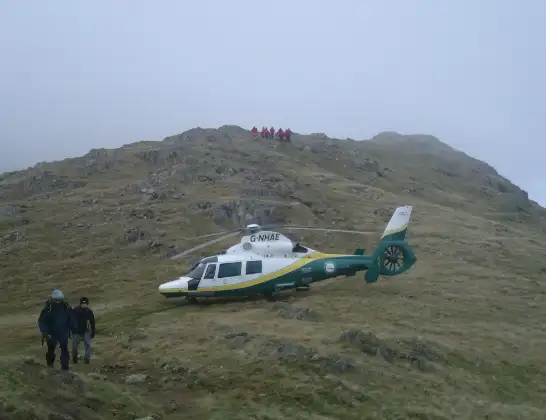
Helicopter: G-NHAE
The helicopter G-NHAE is used as a air ambulance helicopter. The main purpose of this aircraft is to transport a Mobile Medical Team to an incident as quickly as possible, enabling the trauma doctor to provide immediate first aid on site. The aircraft is flying this flight as Air Ambulance Helicopter.
Photo: Michael Earnshaw
30 miles
1750 feet
148 mph
13 minutes
12:14
12:26

Route
Edenhall, 12:26
Edenhall12:25
Langwathby12:25
Skirwith12:25
Melmerby12:25
Skirwith12:24
Ousby12:24
Skelling Farm Glider Field, Skirwith, Penrith12:24
Skirwith12:23
Blencarn12:22
Culgaith12:22
Brougham12:20
Eamont Bridge12:20
Penrith12:20
Stainton12:19
Dacre12:18
Hutton12:18
Penruddock12:18
Greystoke12:17
Great Blencow12:17
Newton Reigny12:16
Catterlen12:16
Plumpton12:15
Skelton12:15
Hesket12:15
Calthwaite, 12:14
Live flights
Today
Coastguard Helicopter to 16:24:21
Flights Edenhall
Air Ambulance Helicopter to Culgaith, B64123 Mar 09:39
Air Ambulance Helicopter to Edenhall7 Feb 15:35
Air Ambulance Helicopter to Irish Sea7 Feb 14:22
Flights Calthwaite
Helicopter flights on your website?
You can easily display helicopter flights on your own website. Use the embed code.
