Air Ambulance Helicopter to Bromesberrow Heath, M50
Wednesday, 25 February 2026 | 14:20 | From Norton
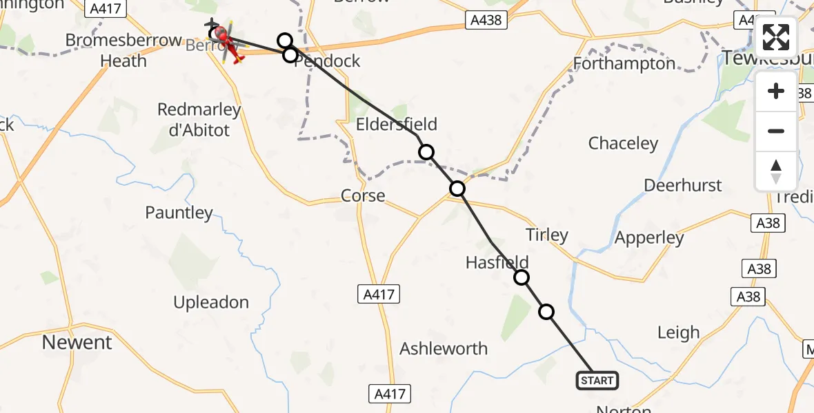
On Wednesday, 25 February 2026 at 14:20, a Air Ambulance Helicopter departed from Norton to Bromesberrow Heath. It was the Air Ambulance Helicopter with registration number G-SCAA. The flight lasted 4 minutes. During that period, the aircraft travelled 9 miles at an average speed of 132 miles per hour at a maximum altitude of 975 feet.
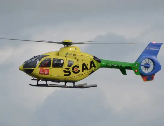
Helicopter: G-SCAA
The helicopter G-SCAA is used as a air ambulance helicopter. The main purpose of this aircraft is to transport a Mobile Medical Team to an incident as quickly as possible, enabling the trauma doctor to provide immediate first aid on site. The aircraft is flying this flight as Air Ambulance Helicopter.
Photo: Jonathan Payne
9 miles
975 feet
132 mph
4 minutes
14:20
14:24

Route
M50, Forest of Dean14:24
Berrow Airstrip, Ledbury, Hertfordshire14:24
Bromesberrow Heath, Forest of Dean14:23
Forest of Dean14:23
Eldersfield, Malvern Hills14:22
Tewkesbury14:22
Tirley, Tewkesbury14:21
Hasfield, Tewkesbury14:20
Norton, Tewkesbury14:20
Live flights
Today
Flights Norton
Police Helicopter to Bournemouth Airport11 May 15:31
Air Ambulance Helicopter to Norton, Beech Road11 Apr 09:51
Air Ambulance Helicopter to Norton, Pascal Way26 Jan 09:57
Helicopter flights on your website?
You can easily display helicopter flights on your own website. Use the embed code.
