Air Ambulance Helicopter to Stranraer
Thursday, 19 February 2026 | 14:22 | From Glasgow Airport
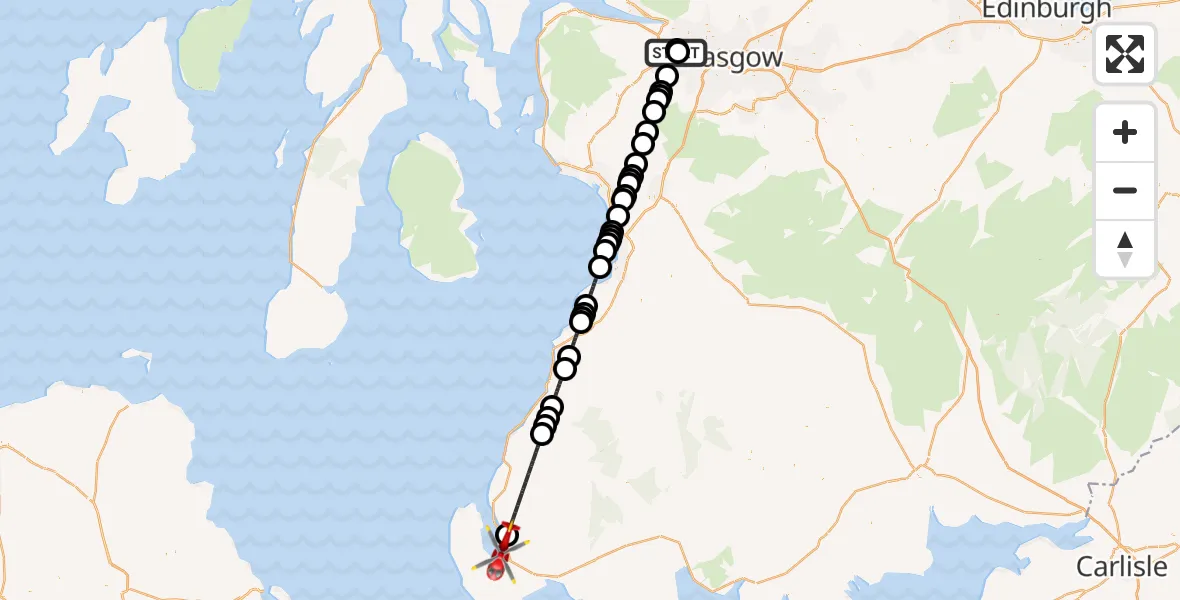
On Thursday, 19 February 2026 at 14:22, a Air Ambulance Helicopter departed from Glasgow Airport to Stranraer. It was the Air Ambulance Helicopter with registration number G-ISAS. The flight lasted 33 minutes. During that period, the aircraft travelled 70 miles at an average speed of 129 miles per hour at a maximum altitude of 2225 feet.
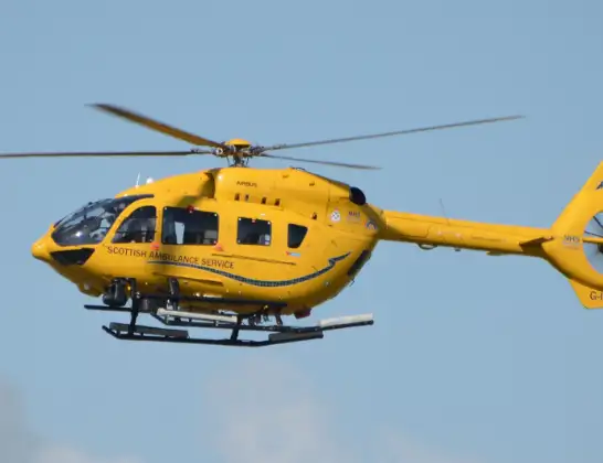
Helicopter: G-ISAS
The helicopter G-ISAS is used as a air ambulance helicopter. The main purpose of this aircraft is to transport a Mobile Medical Team to an incident as quickly as possible, enabling the trauma doctor to provide immediate first aid on site. The aircraft is flying this flight as Air Ambulance Helicopter.
Photo: Jonathan Payne
70 miles
2225 feet
129 mph
33 minutes
14:22
14:54

Route
Stranraer, 14:54
Stranraer14:53
Colmonell14:47
Poundland14:46
Girvan14:46
Pinmore14:45
Girvan14:43
Dailly14:42
Kirkoswald14:40
Dunure14:39
Fisherton14:39
Maybole14:39
Alloway14:36
Ayr14:35
Troon14:35
Loans14:34
Troon14:34
Prestwick14:34
Loans14:33
Dundonald14:32
Drybridge14:32
Springside14:31
Cunninghamhead14:31
Knockentiber14:30
Cunninghamhead14:30
Stewarton14:28
Dunlop14:28
Lugton14:26
Uplawmoor14:26
Shillford14:25
Neilston14:25
Elderslie14:24
Paisley14:22
Renfrew14:22
Glasgow Airport, Glasgow14:22
Live flights
Police Helicopter on its way from RAF Benson12 Jul 22:54
Police Helicopter on its way from Dundrod12 Jul 22:50
Police Helicopter on its way from East Ardsley12 Jul 22:44
Today
Air Ambulance Helicopter to Glasgow Airport12 Jul 22:48
Air Ambulance Helicopter to Norwich Airport12 Jul 22:27
Air Ambulance Helicopter to Northrepps Aerodrome12 Jul 22:23
Police Helicopter to Harborough, Sulby Road12 Jul 22:20
Air Ambulance Helicopter to Derriford Hospital12 Jul 22:12
Police Helicopter to Manchester Barton Aerodrome12 Jul 22:11
Air Ambulance Helicopter to Northrepps Aerodrome12 Jul 22:03
Flights Stranraer
Air Ambulance Helicopter to Glasgow Airport23 May 23:51
Air Ambulance Helicopter to Knee of Cairnsmore18 May 15:52
Air Ambulance Helicopter to Stranraer18 May 13:06
Air Ambulance Helicopter to Pinmore4 May 17:17
Air Ambulance Helicopter to Stranraer4 May 16:22
Air Ambulance Helicopter to Laurieston26 Apr 06:19
Air Ambulance Helicopter to Stranraer26 Apr 03:59
Air Ambulance Helicopter to Glasgow Airport16 Mar 18:49
Helicopter flights on your website?
You can easily display helicopter flights on your own website. Use the embed code.
