Air Ambulance Helicopter to Cockermouth, Pinfold Close
Sunday, 8 February 2026 | 16:14 | From Edenhall
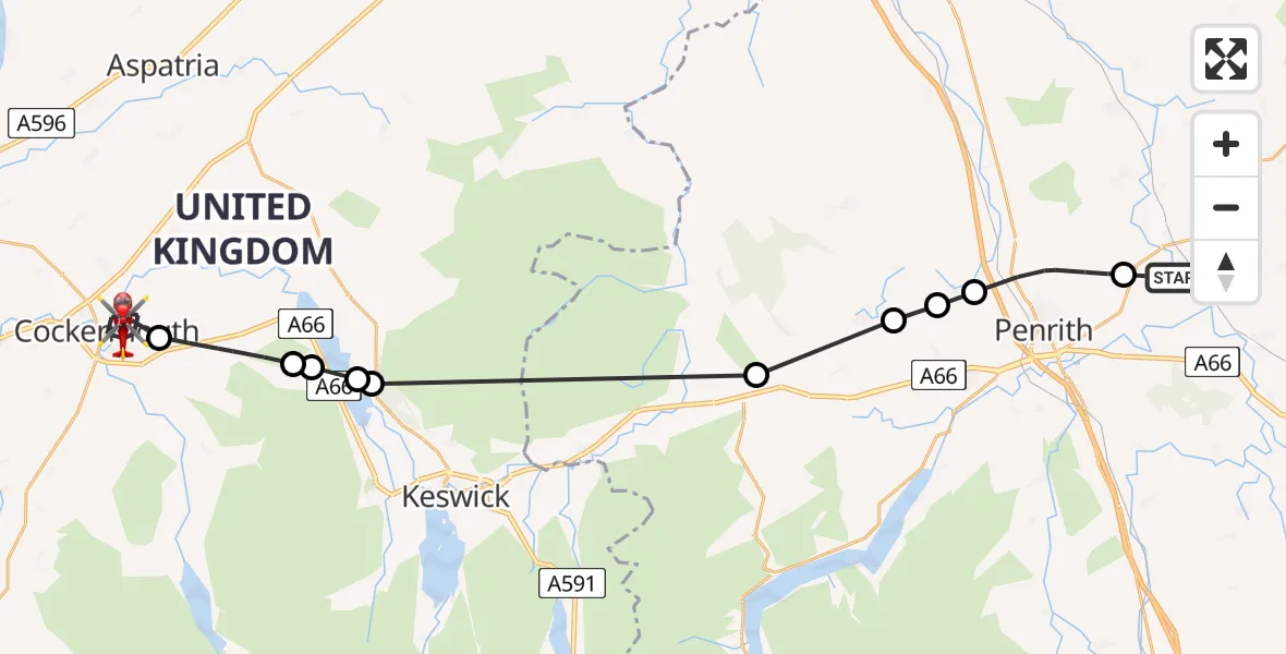
On Sunday, 8 February 2026 at 16:14, a Air Ambulance Helicopter departed from Edenhall to Cockermouth. It was the Air Ambulance Helicopter with registration number G-NHAE. The flight lasted 15 minutes. During that period, the aircraft travelled 31 miles at an average speed of 128 miles per hour at a maximum altitude of 2175 feet.
Helicopter: G-NHAE
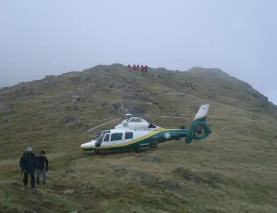
The helicopter G-NHAE is used as a air ambulance helicopter. The main purpose of this aircraft is to transport a Mobile Medical Team to an incident as quickly as possible, enabling the trauma doctor to provide immediate first aid on site. The aircraft is flying this flight as Air Ambulance Helicopter.
Photo: Michael Earnshaw
32 miles
2175 feet
128 mph
15 minutes
16:14
16:29

Route
Cockermouth16:29
Pinfold Close, 16:28
Cockermouth16:25
Embleton16:23
Wythop16:23
Bassenthwaite Lake16:23
Bassenthwaite16:23
Hutton16:19
Great Blencow16:17
Newbiggin16:17
Newton Reigny16:16
Penrith16:15
Ladies Walk, 16:14
Live flights
Today
Police Helicopter to Epping Forest, Green Lane26 Feb 23:43
Flights Cockermouth
Flights Edenhall
Air Ambulance Helicopter to Irish Sea, Irish Sea16 Jan 09:53
Helicopter flights on your website?
You can easily display helicopter flights on your own website. Use the embed code.
