Air Ambulance Helicopter to Irish Sea
Friday, 16 January 2026 | 9:53 | From Edenhall
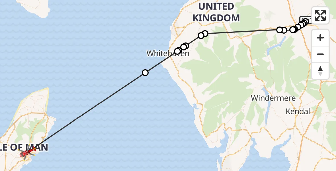
On Friday, 16 January 2026 at 9:53, a Air Ambulance Helicopter departed from Edenhall to Irish Sea. It was the Air Ambulance Helicopter with registration number G-NHAE. The flight lasted 37 minutes. During that period, the aircraft travelled 83 miles at an average speed of 136 miles per hour at a maximum altitude of 2225 feet.
Helicopter: G-NHAE
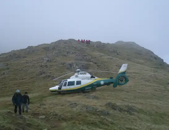
The helicopter G-NHAE is used as a air ambulance helicopter. The main purpose of this aircraft is to transport a Mobile Medical Team to an incident as quickly as possible, enabling the trauma doctor to provide immediate first aid on site. The aircraft is flying this flight as Air Ambulance Helicopter.
Photo: Michael Earnshaw
84 miles
2225 feet
136 mph
37 minutes
09:53
10:30

Route
Irish Sea, 10:30
Irish Sea10:14
Moresby Parks10:10
Weddicar10:10
Arlecdon10:09
Asby10:09
Pardshaw10:07
Blindbothel10:06
Penruddock09:57
Dacre09:57
Stainton09:56
Sockbridge09:56
Tirril09:56
Yanwath09:55
Eamont Bridge09:55
Penrith09:54
Langwathby09:54
Penrith09:54
Edenhall, 09:53
Live flights
Today
Flights Edenhall
Air Ambulance Helicopter to Irish Sea26 May 16:12
Air Ambulance Helicopter to Greystoke26 May 13:33
Air Ambulance Helicopter to Edenhall24 May 15:17
Air Ambulance Helicopter to Waverton24 May 11:44
Helicopter flights on your website?
You can easily display helicopter flights on your own website. Use the embed code.
