Coastguard Helicopter to Portmahomack, Tarbatness Road
Friday, 30 January 2026 | 17:09 | From Ardersier
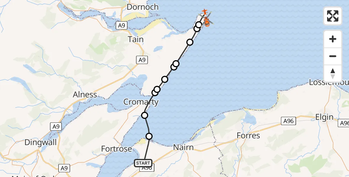
On Friday, 30 January 2026 at 17:09, a Coastguard Helicopter departed from Ardersier to Portmahomack. It was the Coastguard Helicopter with registration number G-MCGT. The flight lasted 12 minutes. During that period, the aircraft travelled 25 miles at an average speed of 121 miles per hour at a maximum altitude of 2075 feet.
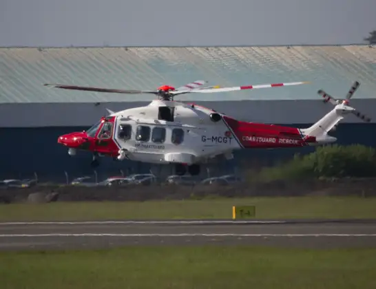
Helicopter: G-MCGT
The helicopter G-MCGT is used by the British Coastguard. The helicopter is deployed in search and rescue operations at sea, rescue operations involving ships or drilling platforms, patrols to prevent smuggling or piracy, environmental monitoring and disaster relief support.
Photo: Ronnie Macdonald
25 miles
2075 feet
121 mph
13 minutes
17:09
17:22

Route
Tarbatness Road, 17:22
Portmahomack17:19
Ballone Castle Airstrip, Tain, Ross17:19
Portmahomack17:18
Hilton of Cadboll17:16
Balintore17:16
Shandwick17:15
Castlecraig17:14
Nigg17:14
Cromarty17:12
North Sea17:11
Old Military Road, 17:09
Today
Police Helicopter to Epping Forest, Green Lane26 Feb 23:43
Flights Portmahomack
Coastguard Helicopter to Ardersier, Rosemarkie28 Jan 18:11
Coastguard Helicopter to North Sea, North Sea12 Jan 17:32
Coastguard Helicopter to North Sea12 Jan 16:26
Coastguard Helicopter to Portmahomack, C101712 Jan 15:50
Flights Ardersier
Air Ambulance Helicopter to Fortrose, Fortrose18 Feb 16:39
Air Ambulance Helicopter to Dingwall, Ardersier18 Feb 11:34
Air Ambulance Aircraft to Inner Seas, Inner Seas12 Feb 13:40
Air Ambulance Aircraft to Aberdeen International Airport, Aberdeen International Airport10 Feb 18:42
Coastguard Helicopter to Inverness, Inverness30 Jan 11:03
Coastguard Helicopter to Ardersier, Rosemarkie28 Jan 18:11
Coastguard Helicopter to North Sea, North Sea28 Jan 14:58
Helicopter flights on your website?
You can easily display helicopter flights on your own website. Use the embed code.
