Air Ambulance Helicopter to Dalnacloich, Rosemarkie
Sunday, 22 February 2026 | 12:28 | From Ardersier
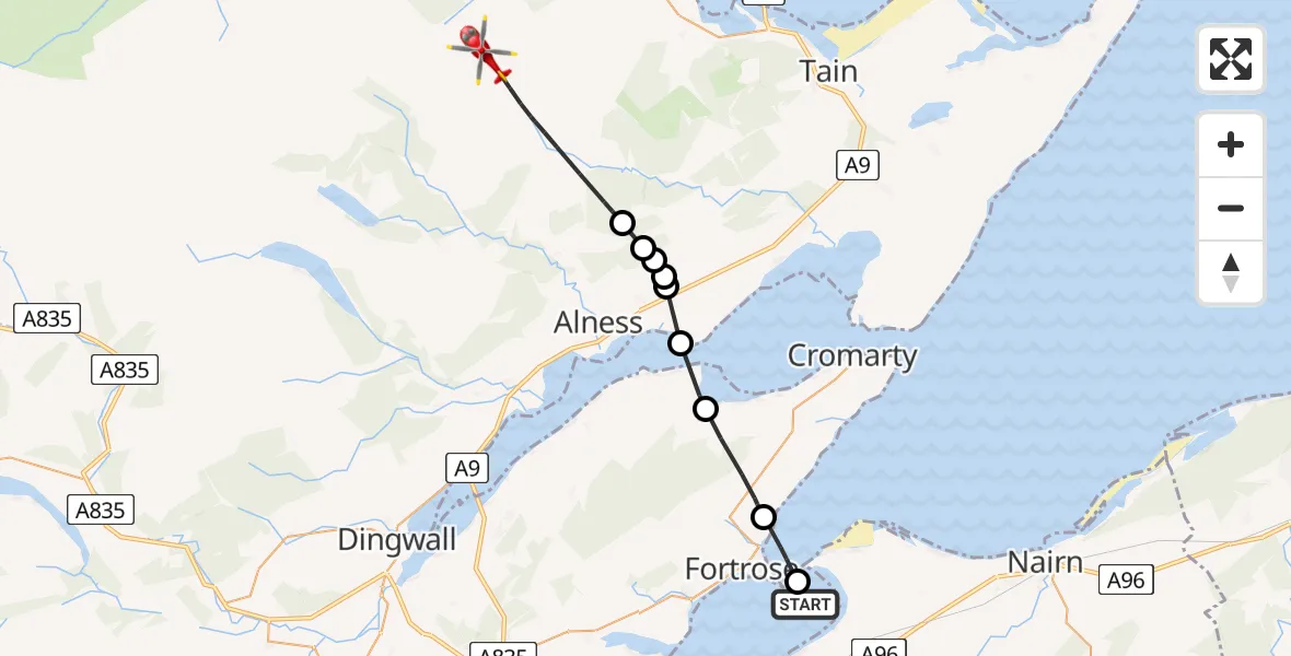
On Sunday, 22 February 2026 at 12:28, a Air Ambulance Helicopter departed from Ardersier to Dalnacloich. It was the Air Ambulance Helicopter with registration number G-GSAS. The flight lasted 9 minutes. During that period, the aircraft travelled 20 miles at an average speed of 130 miles per hour at a maximum altitude of 2750 feet.
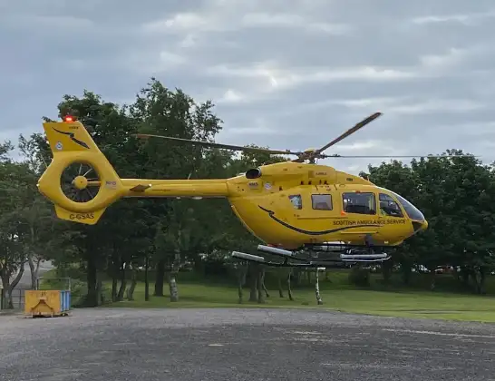
Helicopter: G-GSAS
The helicopter G-GSAS is used as a air ambulance helicopter. The main purpose of this aircraft is to transport a Mobile Medical Team to an incident as quickly as possible, enabling the trauma doctor to provide immediate first aid on site. The aircraft is flying this flight as Air Ambulance Helicopter.
Photo: Scanbus
21 miles
2750 feet
130 mph
10 minutes
12:28
12:37

Route
12:37
Dalnacloich12:34
Dalnavie12:33
Alness12:33
Rhicullen12:33
Kildary12:33
Invergordon12:32
Jemimaville12:31
Fortrose12:29
Rosemarkie, 12:28
Ardersier12:28
Today
Flights Dalnacloich
Flights Ardersier
Air Ambulance Helicopter to Highland11 Jul 11:02
Air Ambulance Helicopter to Scatinan, Searchlight Emplacement (Second World War) - Twartquoy9 Jul 12:46
Coastguard Helicopter to Inverness Airport9 Jul 11:59
Air Ambulance Helicopter to Edderton7 Jul 10:25
Air Ambulance Helicopter to North Sea5 Jul 20:29
Air Ambulance Helicopter to Loch Luichart1 Jul 14:53
Air Ambulance Helicopter to Ardersier29 Jun 12:34
Air Ambulance Helicopter to Inverness Airport29 Jun 08:50
Coastguard Helicopter to Inverness Airport25 Jun 16:01
Helicopter flights on your website?
You can easily display helicopter flights on your own website. Use the embed code.
