Coastguard Helicopter to Portmahomack, C1017
Monday, 12 January 2026 | 15:50 | From Tornagrain
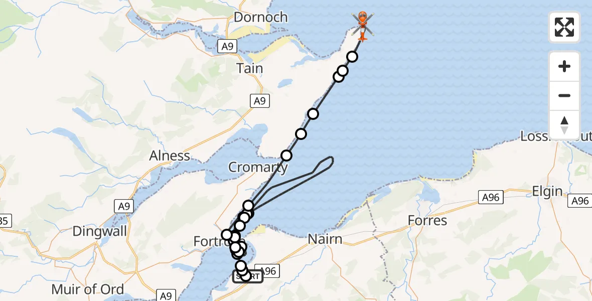
On Monday, 12 January 2026 at 15:50, a Coastguard Helicopter departed from Tornagrain to Portmahomack. It was the Coastguard Helicopter with registration number G-MCGT. The flight lasted 35 minutes. During that period, the aircraft travelled 57 miles at an average speed of 98 miles per hour at a maximum altitude of 2300 feet.
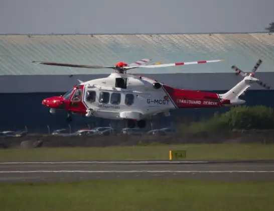
Helicopter: G-MCGT
The helicopter G-MCGT is used by the British Coastguard. The helicopter is deployed in search and rescue operations at sea, rescue operations involving ships or drilling platforms, patrols to prevent smuggling or piracy, environmental monitoring and disaster relief support.
Photo: Ronnie Macdonald
57 miles
2300 feet
98 mph
35 minutes
15:50
16:24

Route
16:24
Portmahomack16:20
Rockfield16:19
Portmahomack16:19
Hilton of Cadboll16:18
Shandwick16:17
Castlecraig16:16
Cromarty16:14
Rosemarkie16:13
Fortrose16:12
Rosemarkie16:12
Ardersier16:10
Rosemarkie16:09
North Sea16:09
Rosemarkie16:07
Fortrose16:06
Cromarty16:06
North Sea15:54
Fortrose15:53
Rosemarkie15:52
Fortrose15:52
Rosemarkie15:51
Inverness15:51
Dalcross Heliport15:50
Inverness15:50
C1017, 15:50
Live flights
Today
Flights Portmahomack
Air Ambulance Helicopter to North Sea21 Mar 22:01
Coastguard Helicopter to Ardersier, Rosemarkie28 Jan 18:11
Flights Tornagrain
Air Ambulance Aircraft to RAF Lossiemouth5 Jul 23:17
Air Ambulance Helicopter to Tornagrain19 Jun 13:24
Air Ambulance Helicopter to Tornagrain, A9611 Jun 18:42
Coastguard Helicopter to Inverness Airport10 Jun 11:37
Air Ambulance Helicopter to Tornagrain7 Jun 14:03
Air Ambulance Helicopter to Tornagrain3 Jun 20:44
Air Ambulance Helicopter to Tornagrain, A9629 May 17:18
Air Ambulance Helicopter to Tornagrain26 Apr 05:46
Helicopter flights on your website?
You can easily display helicopter flights on your own website. Use the embed code.
