Police Helicopter to MOD St Athan, MOD St Athan
Wednesday, 28 January 2026 | 23:00 | From Llancarfan
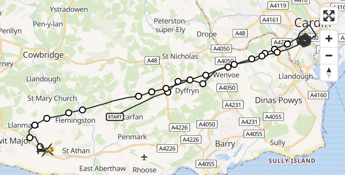
On Wednesday, 28 January 2026 at 23:00, a Police Helicopter departed from Llancarfan to MOD St Athan. It was the Police Helicopter with registration number G-NWOI. The flight lasted 28 minutes. During that period, the aircraft travelled 42 miles at an average speed of 90 miles per hour at a maximum altitude of 2400 feet.
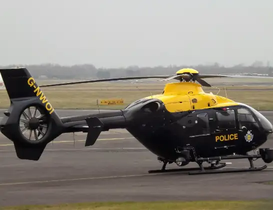
Helicopter: G-NWOI
The helicopter G-NWOI is used by the British police. The helicopter is deployed in pursuits, missing persons cases and other incidents where a helicopter provides added value.
Photo: James from Cheltenham
42 miles
2400 feet
90 mph
28 minutes
23:00
23:28

Route
MOD St Athan, St Athan, Vale of Glamorgan23:28
MOD St Athan, St Athan, Vale of Glamorgan23:28
Boverton23:28
Llanmaes23:27
St Mary Church23:27
Flemingston23:26
Llanfair23:26
Llancarfan23:25
Dyffryn23:25
Bonvilston23:25
Dyffryn23:24
Wenvoe23:23
Michaelston-le-Pit23:23
Llandough23:23
Cardiff23:04
Michaelston-le-Pit and Leckwith23:04
Michaelston-le-Pit23:04
Michaelston-le-Pit and Leckwith23:03
Wenvoe23:03
Dyffryn23:02
St Nicholas23:02
St Nicholas and Bonvilston23:02
Dyffryn23:02
Llancarfan, 23:00
Live flights
Today
Flights Llancarfan
to Llancarfan, Llancarfan14 Feb 16:08
Police Helicopter to Goodrich, A407 Feb 08:24
Police Helicopter to Llanover, Usk Road29 Jan 14:42
Police Helicopter to MOD St Athan, MOD St Athan28 Jan 23:00
Police Helicopter to Boverton, Mill Lane28 Jan 10:20
Police Helicopter to MOD St Athan, MOD St Athan28 Jan 02:04
Police Helicopter to Newport, Heol Pont y Cwcw26 Jan 08:38
Police Helicopter to Boverton, Mill Lane17 Jan 22:09
Helicopter flights on your website?
You can easily display helicopter flights on your own website. Use the embed code.
