Police Helicopter to MOD St Athan
Wednesday, 28 January 2026 | 2:04 | From Llancarfan
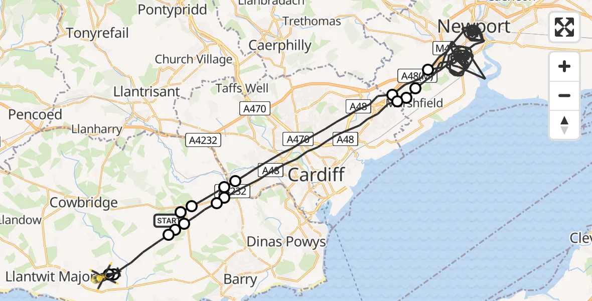
On Wednesday, 28 January 2026 at 2:04, a Police Helicopter departed from Llancarfan to MOD St Athan. It was the Police Helicopter with registration number G-NWOI. The flight lasted 45 minutes. During that period, the aircraft travelled 85 miles at an average speed of 114 miles per hour at a maximum altitude of 2775 feet.

Helicopter: G-NWOI
The helicopter G-NWOI is used by the British police. The helicopter is deployed in pursuits, missing persons cases and other incidents where a helicopter provides added value.
Photo: Alec Wilson
85 miles
2775 feet
114 mph
45 minutes
02:04
02:49

Route
MOD St Athan, St Athan, Vale of Glamorgan02:49
MOD St Athan, St Athan, Vale of Glamorgan02:48
St Athan02:48
Llancarfan02:47
St Nicholas and Bonvilston02:47
Bonvilston02:46
St Nicholas02:46
Drope02:45
Cardiff02:41
Marshfield, Newport02:41
Castleton, Newport02:41
Newport02:10
Castleton, Newport02:09
Cardiff02:05
Drope02:05
St Nicholas02:04
Bonvilston02:04
Llancarfan, 02:04
Today
Flights Llancarfan
Air Ambulance Helicopter to Cardiff Heliport27 May 16:00
Air Ambulance Helicopter to Llancarfan27 May 14:38
Police Helicopter to MOD St Athan21 Mar 21:21
Police Helicopter to Kidlington, Llancadle Road20 Mar 11:18
Police Helicopter to MOD St Athan18 Mar 10:40
Police Helicopter to MOD St Athan17 Mar 20:39
Police Helicopter to MOD St Athan4 Mar 18:36
Police Helicopter to MOD St Athan28 Feb 19:27
Police Helicopter to Llancarfan27 Feb 13:38
Helicopter flights on your website?
You can easily display helicopter flights on your own website. Use the embed code.
