Police Helicopter to Speldhurst, Ashurst Road
Tuesday, 27 January 2026 | 13:53 | From South Nutfield
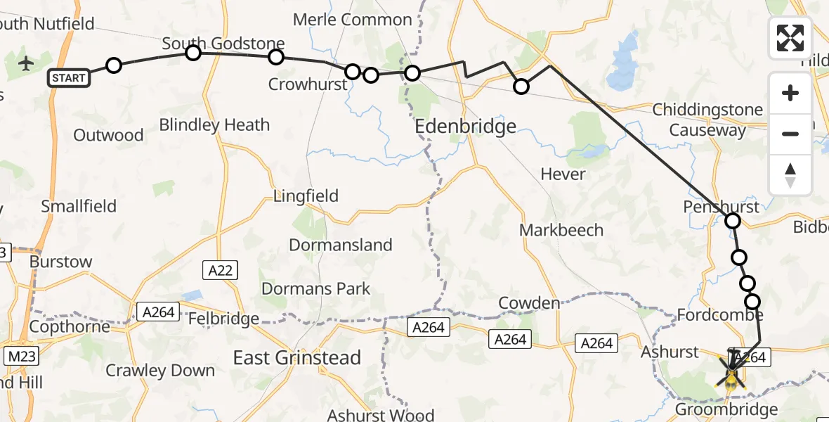
On Tuesday, 27 January 2026 at 13:53, a Police Helicopter departed from South Nutfield to Speldhurst. It was the Police Helicopter with registration number G-POLH. The flight lasted 13 minutes. During that period, the aircraft travelled 19 miles at an average speed of 89 miles per hour at a maximum altitude of 1900 feet.
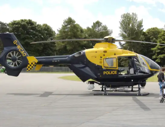
Helicopter: G-POLH
The helicopter G-POLH is used by the British police. The helicopter is deployed in pursuits, missing persons cases and other incidents where a helicopter provides added value.
Photo: Arpingstone
19 miles
1900 feet
89 mph
13 minutes
13:53
14:06

Route
Ashurst Road, Tunbridge Wells14:06
Speldhurst, Tunbridge Wells14:03
Fordcombe, Sevenoaks14:02
Sevenoaks14:02
Penshurst, Sevenoaks14:01
Hever, Sevenoaks13:58
Edenbridge13:57
Tandridge13:56
Homefield Farm / Edenbridge Airstrip13:56
Crowhurst13:55
South Godstone13:55
Tandridge13:54
Coopers Hill Road, 13:53
Live flights
Today
Flights Speldhurst
Police Helicopter to Speldhurst, Ashurst Road27 Jan 13:53
Air Ambulance Helicopter to Redhill Aerodrome24 Jan 18:03
Helicopter flights on your website?
You can easily display helicopter flights on your own website. Use the embed code.
