Air Ambulance Helicopter to Speldhurst, Ashurst Hill
Saturday, 24 January 2026 | 17:37 | From Tunbridge Wells Hospital Heliport
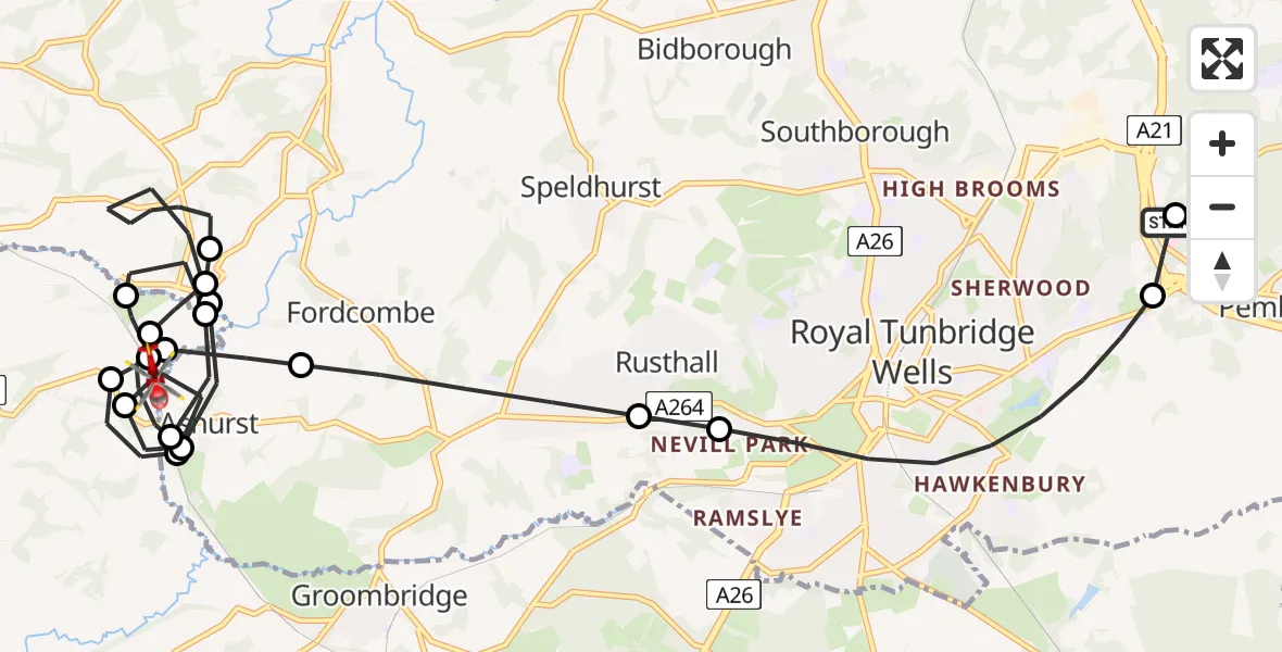
On Saturday, 24 January 2026 at 17:37, a Air Ambulance Helicopter departed from Tunbridge Wells Hospital Heliport to Speldhurst. It was the Air Ambulance Helicopter with registration number G-LNAC. The flight lasted 14 minutes. During that period, the aircraft travelled 18 miles at an average speed of 79 miles per hour at a maximum altitude of 1900 feet.
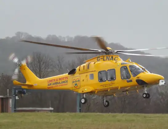
Helicopter: G-LNAC
The helicopter G-LNAC is used as a air ambulance helicopter. The main purpose of this aircraft is to transport a Mobile Medical Team to an incident as quickly as possible, enabling the trauma doctor to provide immediate first aid on site. The aircraft is flying this flight as Air Ambulance Helicopter.
Photo: James from Cheltenham, Gloucestershire
18 miles
1900 feet
79 mph
14 minutes
17:37
17:51

Route
Ashurst Hill, Tunbridge Wells17:51
Speldhurst, Tunbridge Wells17:50
Wealden17:50
Sevenoaks17:49
Speldhurst, Tunbridge Wells17:48
Wealden17:47
Sevenoaks17:47
Fordcombe, Sevenoaks17:47
Sevenoaks17:45
Speldhurst, Tunbridge Wells17:44
Wealden17:44
Speldhurst, Tunbridge Wells17:43
Wealden17:42
Speldhurst, Tunbridge Wells17:42
Fordcombe, Sevenoaks17:41
Speldhurst, Tunbridge Wells17:40
Rusthall, Tunbridge Wells17:40
Royal Tunbridge Wells, Tunbridge Wells17:38
Pembury, Royal Tunbridge Wells17:37
Tonbridge Road, Royal Tunbridge Wells17:37
Live flights
Today
Flights Speldhurst
Police Helicopter to Speldhurst, Ashurst Road27 Jan 13:53
Air Ambulance Helicopter to Redhill Aerodrome24 Jan 18:03
Helicopter flights on your website?
You can easily display helicopter flights on your own website. Use the embed code.
