Police Helicopter to Tattenhall, High Street
Saturday, 24 January 2026 | 16:43 | From Eccles
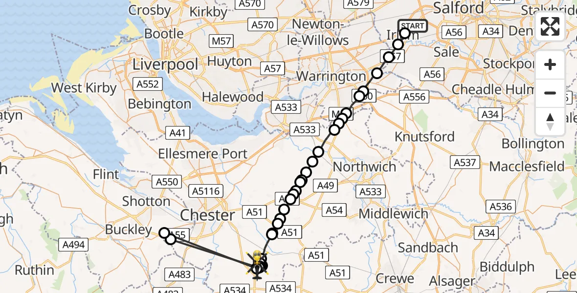
On Saturday, 24 January 2026 at 16:43, a Police Helicopter departed from Eccles to Tattenhall. It was the Police Helicopter with registration number G-EMID. The flight lasted 19 minutes. During that period, the aircraft travelled 52 miles at an average speed of 166 miles per hour at a maximum altitude of 1850 feet.
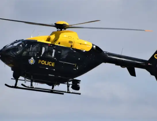
Helicopter: G-EMID
The helicopter G-EMID is used by the British police. The helicopter is deployed in pursuits, missing persons cases and other incidents where a helicopter provides added value.
Photo: Alec Wilson
53 miles
1850 feet
166 mph
19 minutes
16:43
17:02

Route
High Street, 17:02
Tattenhall17:01
Broughton17:00
Chester17:00
Tattenhall16:59
Chester16:59
Tattenhall16:59
Chester16:57
Tattenhall16:57
Chester16:56
Tattenhall16:55
Chester16:54
Duddon16:54
Tarporley16:53
Duddon16:53
Willington16:52
Kelsall16:52
Delamere and Oakmere16:52
Delamere16:51
Delamere and Oakmere16:51
Norley16:51
Frodsham16:51
Crowton16:50
Acton Bridge16:49
Lower Whitley16:48
Higher Whitley16:48
Stretton16:48
Stretton, Liverpool City Region16:47
Appleton Thorn16:46
Grappenhall and Thelwall16:46
Lymm16:45
Hollins Green16:44
Cadishead, Salford16:44
Irlam, Salford16:43
Liverpool Road, Manchester16:43
Live flights
Today
Police Helicopter to Manchester Barton Aerodrome13 Jul 23:56
Police Helicopter to Bournemouth Airport13 Jul 23:55
Air Ambulance Helicopter to Cardiff Heliport13 Jul 23:38
Police Helicopter to Harborough, Sulby Road13 Jul 23:36
Police Helicopter to Birmingham Airport13 Jul 23:21
Flights Tattenhall
Police Helicopter to Manchester Barton Aerodrome24 Jan 17:37
Police Helicopter to Tattenhall, Frog Lane24 Jan 17:30
Police Helicopter to Tattenhall, High Street24 Jan 17:21
Police Helicopter to Tattenhall, Brockway West24 Jan 17:08
Police Helicopter to Tattenhall, High Street24 Jan 17:04
Police Helicopter to Tattenhall, High Street24 Jan 16:43
Flights Eccles
Police Helicopter to Davenham, Davenham Road8 Jul 17:58
Police Helicopter to Irlam, Trident Road6 Jul 18:01
Police Helicopter to Bryneglwys4 Jul 07:40
Police Helicopter to Chorley, Belmont Road2 Jul 16:40
Police Helicopter to Worsley, M6229 Jun 15:13
Air Ambulance Helicopter to Nottingham Heliport28 Jun 17:55
Helicopter flights on your website?
You can easily display helicopter flights on your own website. Use the embed code.
