Air Ambulance Helicopter to Ruthven, General Wade's Military Road
Thursday, 15 January 2026 | 16:10 | From Tomatin
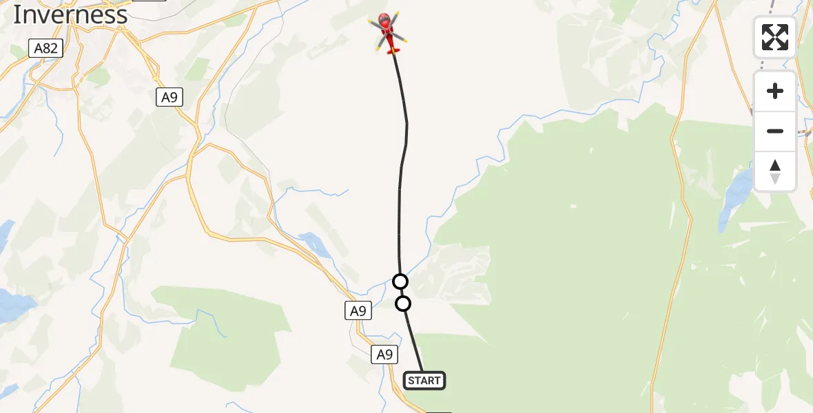
On Thursday, 15 January 2026 at 16:10, a Air Ambulance Helicopter departed from Tomatin to Ruthven. It was the Air Ambulance Helicopter with registration number G-GSAS. The flight lasted 4 minutes. During that period, the aircraft travelled 10 miles at an average speed of 157 miles per hour at a maximum altitude of 3175 feet.
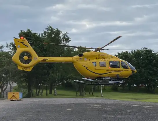
Helicopter: G-GSAS
The helicopter G-GSAS is used as a air ambulance helicopter. The main purpose of this aircraft is to transport a Mobile Medical Team to an incident as quickly as possible, enabling the trauma doctor to provide immediate first aid on site. The aircraft is flying this flight as Air Ambulance Helicopter.
Photo: Scanbus
11 miles
3175 feet
157 mph
4 minutes
16:10
16:14

Route
16:14
Ruthven16:11
Corry Bruoch Beg16:11
General Wade's Military Road, 16:10
Live flights
Today
Flights Ruthven
Air Ambulance Helicopter to Brinmore, B8519 Feb 14:06
Flights Tomatin
Coastguard Helicopter to Tomatin, Tomatin3 Feb 12:00
Coastguard Helicopter to Inverness, Ashton Road17 Jan 16:04
Coastguard Helicopter to Tomatin, B900617 Jan 14:09
Helicopter flights on your website?
You can easily display helicopter flights on your own website. Use the embed code.
