Coastguard Helicopter to Tomatin, Inverness Airport
Tuesday, 24 February 2026 | 14:37 | From Inverness Airport
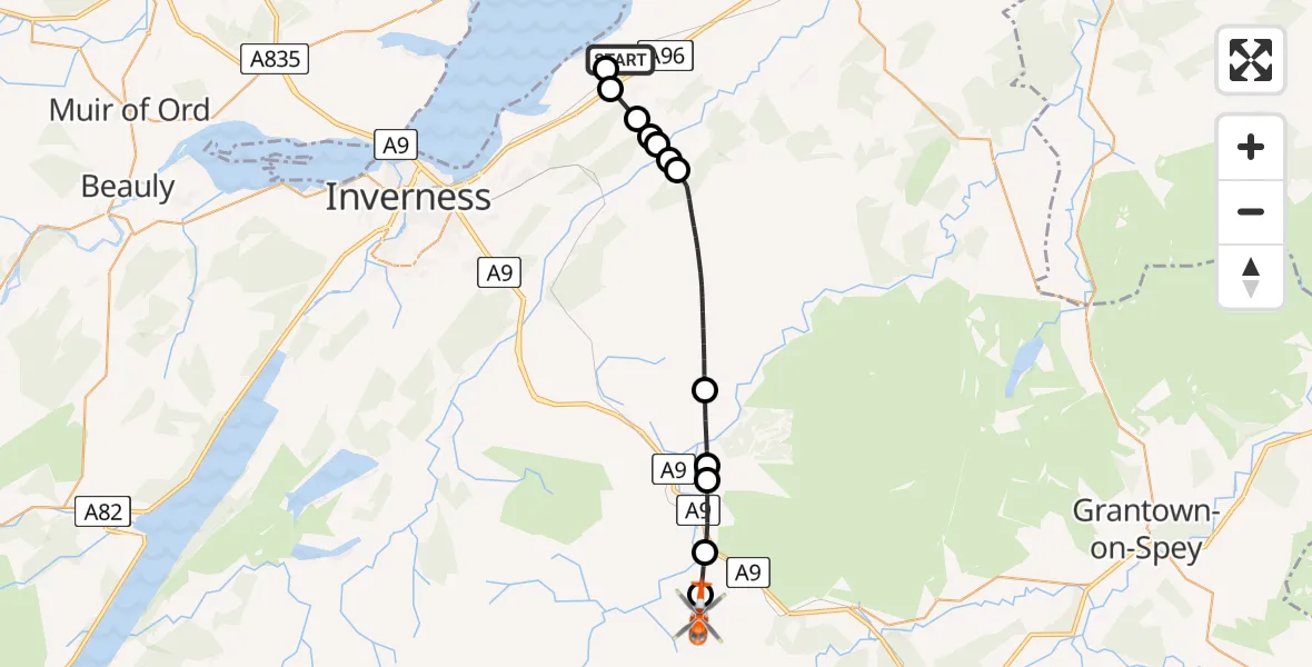
On Tuesday, 24 February 2026 at 14:37, a Coastguard Helicopter departed from Inverness Airport to Tomatin. It was the Coastguard Helicopter with registration number G-MCGT. The flight lasted 12 minutes. During that period, the aircraft travelled 18 miles at an average speed of 91 miles per hour at a maximum altitude of 2975 feet.

Helicopter: G-MCGT
The helicopter G-MCGT is used by the British Coastguard. The helicopter is deployed in search and rescue operations at sea, rescue operations involving ships or drilling platforms, patrols to prevent smuggling or piracy, environmental monitoring and disaster relief support.
Photo: Ronnie Macdonald
19 miles
2975 feet
91 mph
13 minutes
14:37
14:49

Route
14:49
Tomatin14:49
Findhorn Bridge14:48
Tomatin14:47
Corry Bruoch Beg14:47
Ruthven14:46
Cawdor14:41
Newlands of Culloden14:41
Croy14:41
Newlands of Culloden14:41
Croy14:40
Tornagrain14:40
Inverness14:39
Inverness Airport, Inverness14:38
Inverness Airport, Inverness14:37
Today
Flights Tomatin
Coastguard Helicopter to Tomatin, Wood End7 Jul 13:33
Coastguard Helicopter to Tomatin, A923 May 14:54
Air Ambulance Helicopter to Tomatin15 Mar 08:07
Air Ambulance Helicopter to Tomatin15 Mar 08:07
Air Ambulance Helicopter to Tomatin15 Mar 08:07
Air Ambulance Helicopter to Tomatin15 Mar 08:07
Air Ambulance Helicopter to Tomatin15 Mar 08:07
Air Ambulance Helicopter to Tomatin15 Mar 08:07
Air Ambulance Helicopter to Tomatin15 Mar 08:07
Helicopter flights on your website?
You can easily display helicopter flights on your own website. Use the embed code.
