Air Ambulance Helicopter to Dorchester, West Walks
Tuesday, 13 January 2026 | 21:39 | From Blandford St. Mary
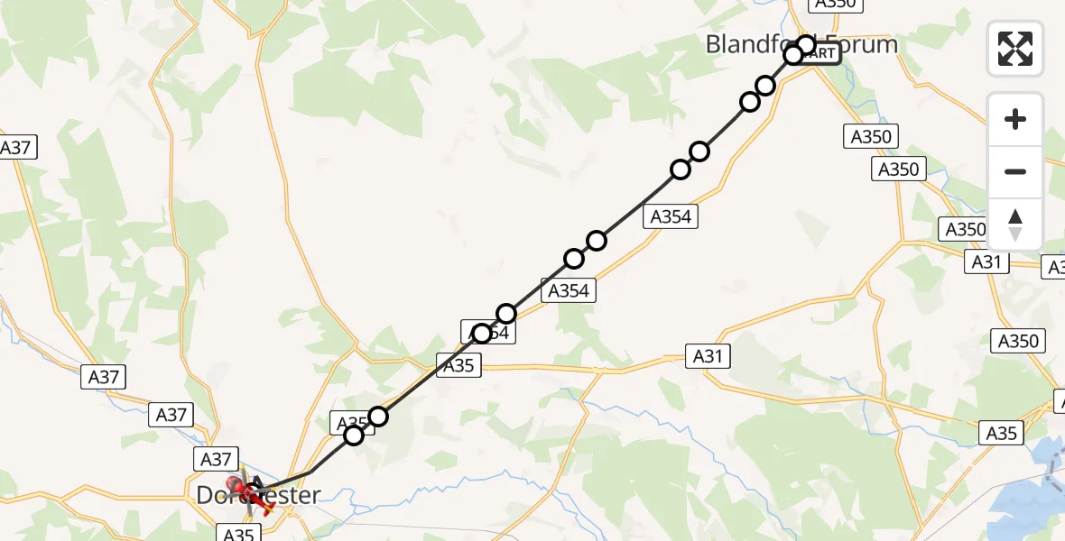
On Tuesday, 13 January 2026 at 21:39, a Air Ambulance Helicopter departed from Blandford St. Mary to Dorchester. It was the Air Ambulance Helicopter with registration number G-DSAA. The flight lasted 9 minutes. During that period, the aircraft travelled 17 miles at an average speed of 111 miles per hour at a maximum altitude of 1375 feet.
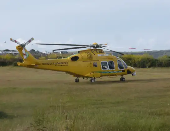
Helicopter: G-DSAA
The helicopter G-DSAA is used as a air ambulance helicopter. The main purpose of this aircraft is to transport a Mobile Medical Team to an incident as quickly as possible, enabling the trauma doctor to provide immediate first aid on site. The aircraft is flying this flight as Air Ambulance Helicopter.
Photo: Andrew Bone
18 miles
1375 feet
111 mph
10 minutes
21:39
21:48

Route
West Walks, 21:48
Dorchester21:46
Stinsford21:45
Athelhampton and Puddletown21:44
Puddletown21:43
Dewlish21:43
Milborne St Andrew21:42
Bagber Farm Airstrip21:42
Winterborne Whitechurch21:41
Winterborne Clenston21:41
Blandford St. Mary21:40
Winterborne Stickland21:40
Fair Mile Road, 21:40
Blandford St. Mary21:39
Blandford Forum21:39
Blandford St. Mary21:39
Live flights
Today
Police Helicopter to Epping Forest, Green Lane26 Feb 23:43
Flights Dorchester
Helicopter flights on your website?
You can easily display helicopter flights on your own website. Use the embed code.
