Air Ambulance Helicopter to Frome, Berkley Road
Friday, 9 January 2026 | 15:15 | From Henstridge
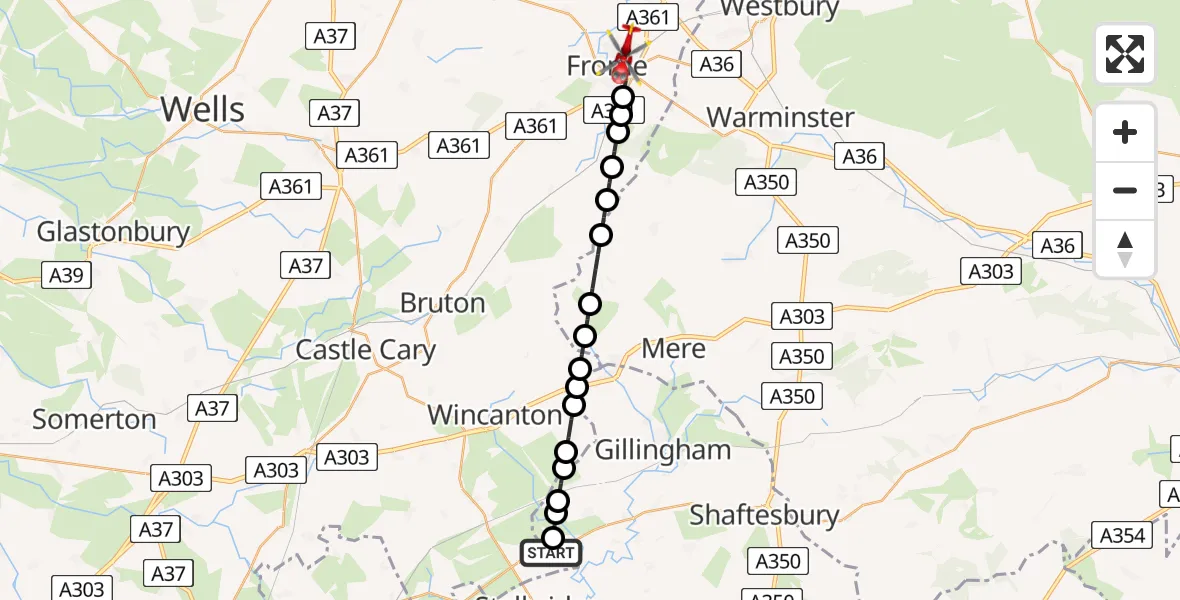
On Friday, 9 January 2026 at 15:15, a Air Ambulance Helicopter departed from Henstridge to Frome. It was the Air Ambulance Helicopter with registration number G-DSAA. The flight lasted 10 minutes. During that period, the aircraft travelled 18 miles at an average speed of 112 miles per hour at a maximum altitude of 1700 feet.
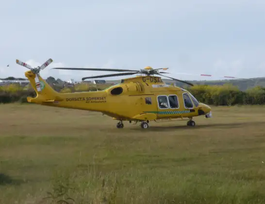
Helicopter: G-DSAA
The helicopter G-DSAA is used as a air ambulance helicopter. The main purpose of this aircraft is to transport a Mobile Medical Team to an incident as quickly as possible, enabling the trauma doctor to provide immediate first aid on site. The aircraft is flying this flight as Air Ambulance Helicopter.
Photo: Andrew Bone
19 miles
1700 feet
112 mph
10 minutes
15:15
15:25

Route
Berkley Road, 15:25
Frome15:22
East Woodlands15:22
15:21
West Woodlands15:21
15:20
Witham Friary15:20
Kilmington15:19
Stourton15:18
Penselwood15:18
Bourton15:18
Milton on Stour15:17
Cucklington15:17
15:16
Buckhorn Weston15:16
15:16
Nyland Lane, 15:15
Kington Magna15:15
Henstridge15:15
Live flights
Today
Police Helicopter to Epping Forest, Green Lane26 Feb 23:43
Flights Frome
Air Ambulance Helicopter to Frome, Frome Bypass21 Feb 10:24
Flights Henstridge
Helicopter flights on your website?
You can easily display helicopter flights on your own website. Use the embed code.
