Police Helicopter on its way from South Nutfield
Thursday, 12 November 2026 | 20:07
On Thursday, 12 November 2026 | 20:07 at 20:07, a Police Helicopter departed from South Nutfield and is now flying over Stanwell. This is the Police Helicopter with registration number G-POLH. The flight has been in the air for 25 minutes. During that period, the aircraft travelled 23 miles at an average speed of 58 miles per hour at a maximum altitude of 1500 feet.
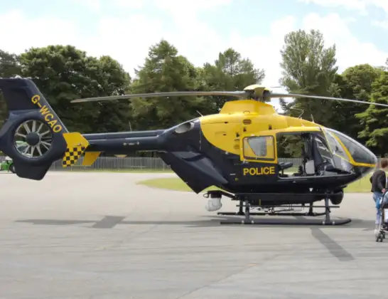
Helicopter: G-POLH
The helicopter G-POLH is used by the British police. The helicopter is deployed in pursuits, missing persons cases and other incidents where a helicopter provides added value.
Photo: Arpingstone

24 miles
1500 feet

58 mph
25 minutes
20:07
20:31:53
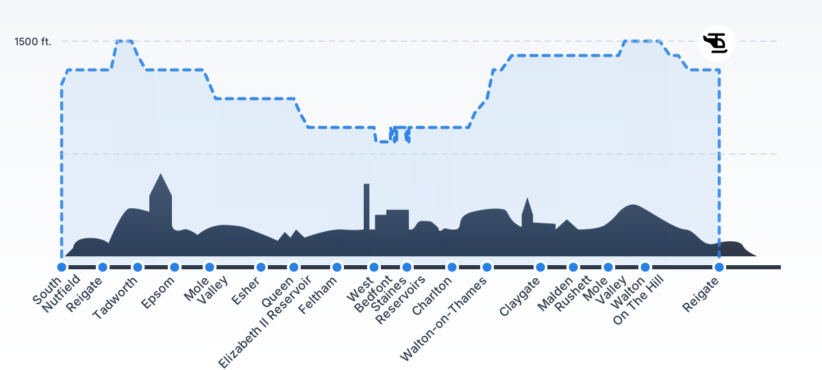
Route

Stanwell, Surrey20:31

Stanwell, Surrey20:31
West Bedfont, Surrey20:20
Bedfont, Surrey20:19
West Bedfont, Surrey20:19
Bedfont, Surrey20:18
Bedfont, Hounslow20:18
Feltham, Hounslow20:17
Kempton Park, Surrey20:16
Spelthorne, Surrey20:16
Elmbridge, Surrey20:15
Molesey, Surrey20:15
Queen Elizabeth II Reservoir20:15
Elmbridge, Surrey20:15
Esher, Surrey20:14
Claygate, Surrey20:13
Birds Hill Estate, Surrey20:13
Rushett Farm, Chessington (Surrey)20:12
Mole Valley, Surrey20:12
Epsom and Ewell, Surrey20:12
Ashtead, Surrey20:11
Epsom, Surrey20:11
Mole Valley, Surrey20:11
Epsom, Surrey20:11
Epsom and Ewell, Surrey20:11
Walton On The Hill, Surrey20:10
Tadworth, Surrey20:10
Lower Kingswood, Surrey20:09
Reigate, Surrey20:08
Redhill, Surrey20:08
South Nutfield, Surrey20:07
Nutfield, Surrey20:07

Bower Hill Lane, Surrey20:07
Live flights


Today


Flights Stanwell

Air Ambulance Helicopter to Redhill Aerodrome15 Aug 19:06
Air Ambulance Helicopter to Redhill Aerodrome24 Feb 13:28
Air Ambulance Helicopter to Stanwell, Clyde Road24 Feb 12:55
Helicopter flights on your website?
You can easily display helicopter flights on your own website. Use the embed code.