Air Ambulance Helicopter to Pakenham, Fen Road
Wednesday, 10 June 2026 | 9:28 | From Norwich Airport
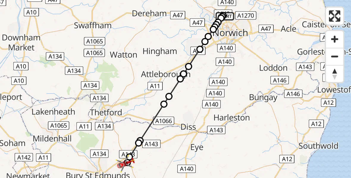
On Wednesday, 10 June 2026 at 9:28, a Air Ambulance Helicopter departed from Norwich Airport to Pakenham. It was the Air Ambulance Helicopter with registration number G-RESU. The flight lasted 21 minutes. During that period, the aircraft travelled 33 miles at an average speed of 96 miles per hour at a maximum altitude of 1175 feet.
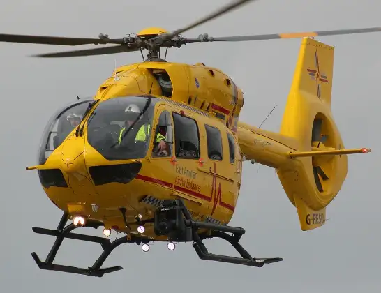
Helicopter: G-RESU
The helicopter G-RESU is used as a air ambulance helicopter. The main purpose of this aircraft is to transport a Mobile Medical Team to an incident as quickly as possible, enabling the trauma doctor to provide immediate first aid on site. The aircraft is flying this flight as Air Ambulance Helicopter.
Photo: Mike Burdett
34 miles
1175 feet
96 mph
21 minutes
09:28
09:49

Route
Fen Road, Suffolk09:49
Pakenham, Suffolk09:49
Ixworth, Suffolk09:46
Stanton, Suffolk09:45
Hepworth, Suffolk09:44
Kenninghall, Norfolk09:41
Banham, Norfolk09:40
Old Buckenham, Norfolk09:38
Breckland, Norfolk09:38
Spooner Row, Norfolk09:37
Wymondham, Norfolk09:35
Hethersett, Norfolk09:35
Little Melton, Norfolk09:34
Norwich, Norfolk09:33
Costessey, Norfolk09:33
Norwich, Norfolk09:33
Costessey, Norfolk09:33
Broadland, Norfolk09:32
Norwich, Norfolk09:32
Broadland, Norfolk09:32
Norwich Airport, Norwich, Norfolk09:30
Norwich Airport, Norwich, Norfolk09:28
Live flights
Today
Flights Pakenham
Air Ambulance Helicopter to Pakenham, Fen Road10 Jun 09:28
Helicopter flights on your website?
You can easily display helicopter flights on your own website. Use the embed code.
