Air Ambulance Helicopter to Chedgrave, Snow's Lane
Monday, 1 June 2026 | 16:04 | From Norwich Airport
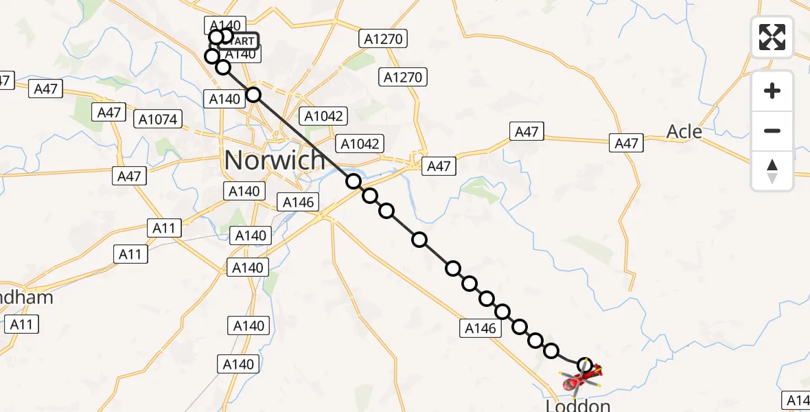
On Monday, 1 June 2026 at 16:04, a Air Ambulance Helicopter departed from Norwich Airport to Chedgrave. It was the Air Ambulance Helicopter with registration number G-RESU. The flight lasted 10 minutes. During that period, the aircraft travelled 15 miles at an average speed of 95 miles per hour at a maximum altitude of 1275 feet.
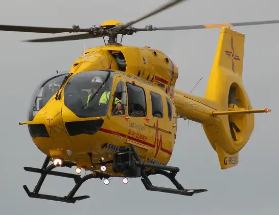
Helicopter: G-RESU
The helicopter G-RESU is used as a air ambulance helicopter. The main purpose of this aircraft is to transport a Mobile Medical Team to an incident as quickly as possible, enabling the trauma doctor to provide immediate first aid on site. The aircraft is flying this flight as Air Ambulance Helicopter.
Photo: Mike Burdett
16 miles
1275 feet
95 mph
10 minutes
16:04
16:14

Route
Snow's Lane, Norfolk16:14
Chedgrave, Norfolk16:12
Langley Street, Norfolk16:12
Pond Farm Airstrip16:12
Ashby St. Mary, Norfolk16:11
Claxton, Norfolk16:11
Ashby St. Mary, Norfolk16:11
Hellington, Norfolk16:11
Rockland St. Mary, Norfolk16:10
Bramerton, Norfolk16:10
South Norfolk, Norfolk16:09
Norwich, Norfolk16:09
Trowse, Norfolk16:09
Norwich, Norfolk16:07
Broadland, Norfolk16:07
Drayton, Norfolk16:07
Norwich, Norfolk16:06
Broadland, Norfolk16:06
Norwich Airport, Norwich, Norfolk16:04
Live flights
Today
Flights Chedgrave
Air Ambulance Helicopter to Norwich Airport3 Jun 07:44
Air Ambulance Helicopter to Norwich Airport1 Jun 17:19
Helicopter flights on your website?
You can easily display helicopter flights on your own website. Use the embed code.
