Air Ambulance Helicopter to Hillingdon, Southill Lane
Monday, 1 June 2026 | 10:39 | From City of Westminster
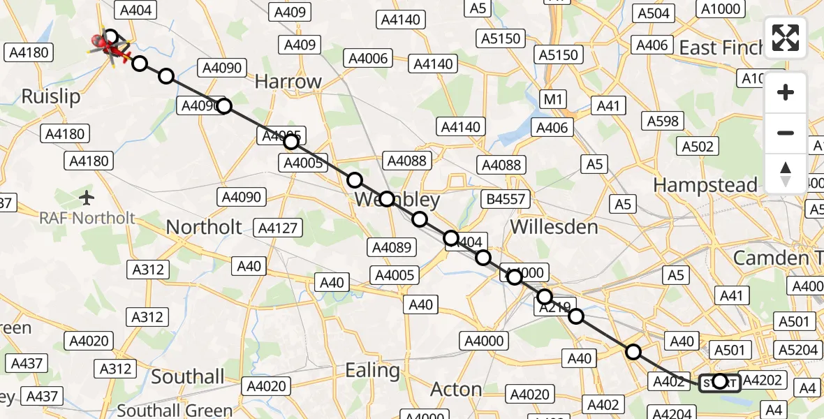
On Monday, 1 June 2026 at 10:39, a Air Ambulance Helicopter departed from City of Westminster to Hillingdon. It was the Air Ambulance Helicopter with registration number G-LAAA. The flight lasted 11 minutes. During that period, the aircraft travelled 13 miles at an average speed of 68 miles per hour at a maximum altitude of 1125 feet.
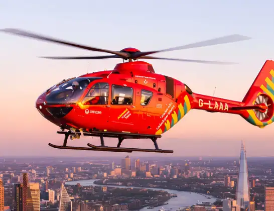
Helicopter: G-LAAA
The helicopter G-LAAA is used as a air ambulance helicopter. The main purpose of this aircraft is to transport a Mobile Medical Team to an incident as quickly as possible, enabling the trauma doctor to provide immediate first aid on site. The aircraft is flying this flight as Air Ambulance Helicopter.
Photo: Ton Snoei
13 miles
1125 feet
68 mph
12 minutes
10:39
10:51

Route
Southill Lane, Greater London - Hillingdon10:51
Northwood, Hillingdon10:49
Hillingdon, Hillingdon10:48
Pinner, Harrow10:48
Rayners Lane, Harrow10:47
Sudbury Hill, Harrow10:47
Sudbury, Brent10:46
Alperton, Brent10:46
Twyford, Brent10:46
Alperton, Brent10:45
Twyford, Brent10:45
Harlesden, Brent10:45
Harlesden, Hammersmith and Fulham10:45
North Kensington, Hammersmith and Fulham10:44
North Kensington, Kensington and Chelsea10:44
West Carriage Drive, Greater London - Westminster10:43
City of Westminster, Westminster10:40
City of Westminster, Greater London - Westminster10:39
Live flights
Police Helicopter on its way from East Ardsley24 Jul 23:19
Today
Air Ambulance Helicopter to Henstridge Airfield24 Jul 23:34
Air Ambulance Helicopter to Cowbridge, A4824 Jul 23:07
Police Helicopter to North Weald Airfield24 Jul 22:53
Air Ambulance Helicopter to Caernarfon Airport24 Jul 22:42
Police Helicopter to Rockbeare, Westcott Road24 Jul 22:17
Police Helicopter to Almondsbury Helicopter Base24 Jul 22:17
Police Helicopter to MOD St Athan24 Jul 22:16
Flights Hillingdon
Air Ambulance Helicopter to RAF Northolt6 Jun 17:07
Air Ambulance Helicopter to RAF Northolt1 Jun 11:34
Helicopter flights on your website?
You can easily display helicopter flights on your own website. Use the embed code.
