Police Helicopter to Brandy Carr, Stoney Lane
Sunday, 24 May 2026 | 1:17 | From Staveley
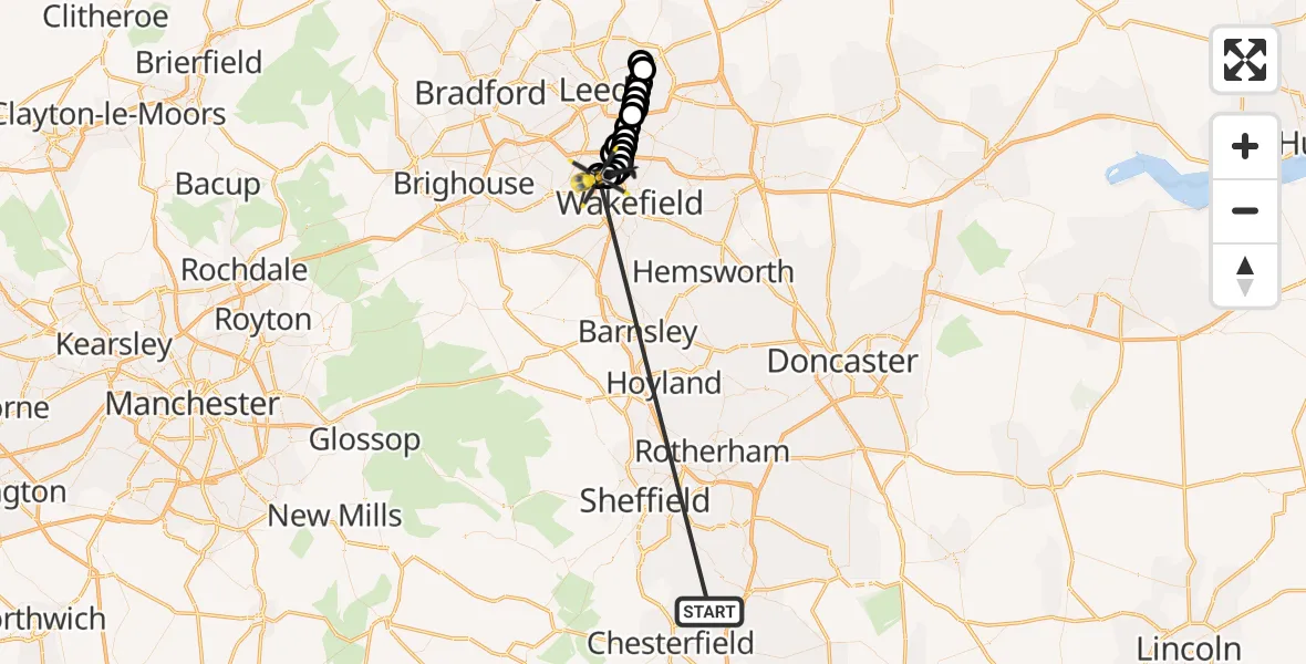
On Sunday, 24 May 2026 at 1:17, a Police Helicopter departed from Staveley to Brandy Carr. It was the Police Helicopter with registration number G-POLB. The flight lasted 39 minutes. During that period, the aircraft travelled 63 miles at an average speed of 98 miles per hour at a maximum altitude of 1100 feet.
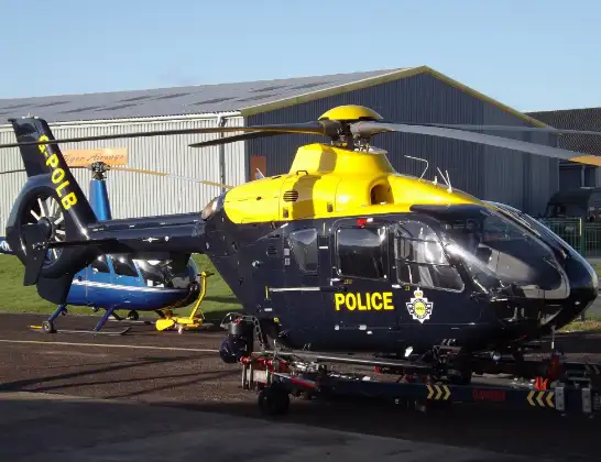
Helicopter: G-POLB
The helicopter G-POLB is used by the British police. The helicopter is deployed in pursuits, missing persons cases and other incidents where a helicopter provides added value.
Photo: James from Cheltenham, Gloucestershire
64 miles
1100 feet
98 mph
39 minutes
01:17
01:56

Route
Stoney Lane, West Yorkshire - Wakefield01:56
East Ardsley, Wakefield01:56
Wrenthorpe, Wakefield01:55
Newton Hill, Wakefield01:55
Lofthouse Gate, Wakefield01:54
Thorpe-on-the-Hill, Leeds01:54
Robin Hood, Leeds01:54
Carlton, Leeds01:54
Rothwell, Leeds01:53
Amazon, Leeds01:53
Leeds, Leeds01:52
Halton Moor, Leeds01:52
Killingbeck, Leeds01:51
Monkswood, Leeds01:21
Killingbeck, Leeds01:21
Halton Moor, Leeds01:21
Leeds, Leeds01:20
Amazon, Leeds01:20
Rothwell, Leeds01:20
Robin Hood, Leeds01:19
Thorpe-on-the-Hill, Leeds01:19
East Ardsley, Leeds01:17
Chesterfield Road, Derbyshire01:17
Live flights
Police Helicopter on its way from RAF Benson12 Jul 22:54
Police Helicopter on its way from Dundrod12 Jul 22:50
Police Helicopter on its way from East Ardsley12 Jul 22:44
Today
Air Ambulance Helicopter to Glasgow Airport12 Jul 22:48
Air Ambulance Helicopter to Norwich Airport12 Jul 22:27
Air Ambulance Helicopter to Northrepps Aerodrome12 Jul 22:23
Police Helicopter to Harborough, Sulby Road12 Jul 22:20
Air Ambulance Helicopter to Derriford Hospital12 Jul 22:12
Police Helicopter to Manchester Barton Aerodrome12 Jul 22:11
Air Ambulance Helicopter to Northrepps Aerodrome12 Jul 22:03
Flights Staveley
Police Helicopter to Brandy Carr, Stoney Lane24 May 20:19
Police Helicopter to East Ardsley, Stoney Lane24 May 17:18
Police Helicopter to East Ardsley, Stoney Lane24 May 16:11
Police Helicopter to East Ardsley, Stoney Lane24 May 12:24
Police Helicopter to East Ardsley, Stoney Lane24 May 11:32
Police Helicopter to Brandy Carr, Stoney Lane24 May 03:56
Police Helicopter to East Ardsley, Stoney Lane24 May 02:51
Police Helicopter to Brandy Carr, Stoney Lane24 May 01:17
Police Helicopter to Staveley24 May 00:26
Helicopter flights on your website?
You can easily display helicopter flights on your own website. Use the embed code.
