Police Helicopter to Bexhill-on-Sea, St Francis Chase
Monday, 4 May 2026 | 22:28 | From South Nutfield
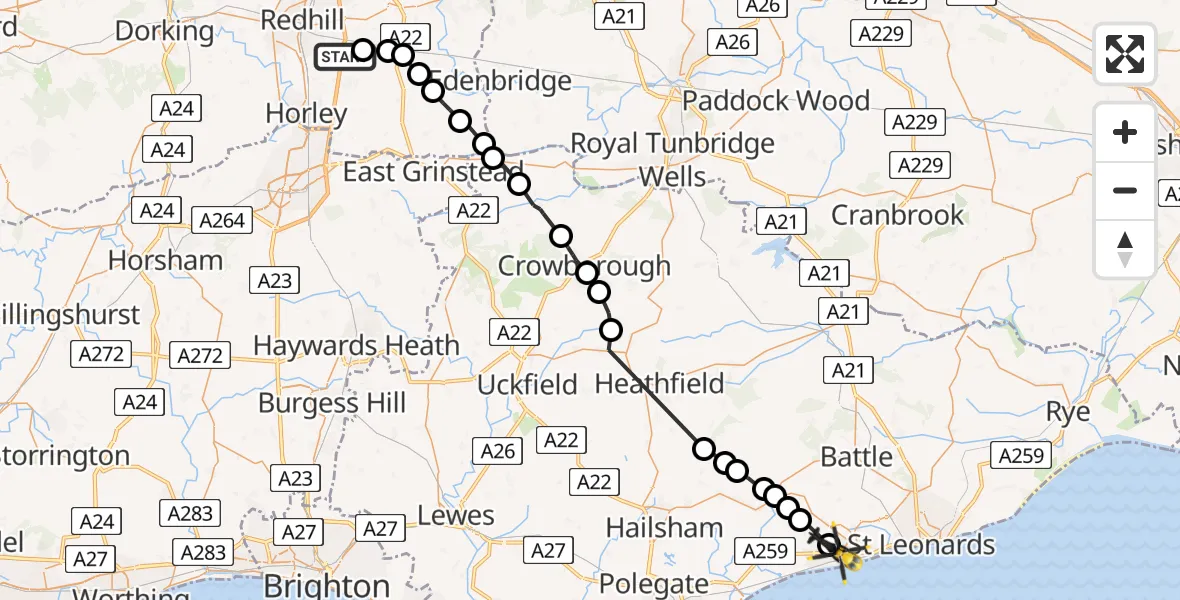
On Monday, 4 May 2026 at 22:28, a Police Helicopter departed from South Nutfield to Bexhill-on-Sea. It was the Police Helicopter with registration number G-POLH. The flight lasted 18 minutes. During that period, the aircraft travelled 38 miles at an average speed of 129 miles per hour at a maximum altitude of 1300 feet.
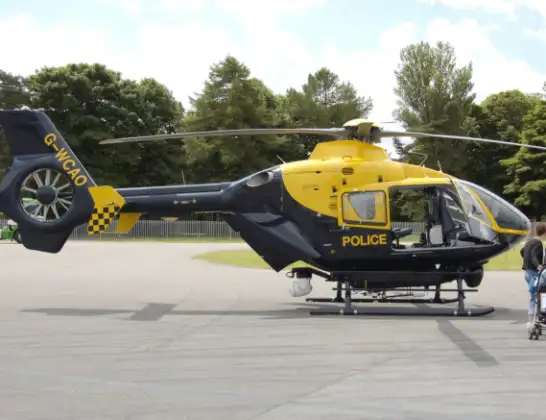
Helicopter: G-POLH
The helicopter G-POLH is used by the British police. The helicopter is deployed in pursuits, missing persons cases and other incidents where a helicopter provides added value.
Photo: Arpingstone
38 miles
1300 feet
129 mph
18 minutes
22:28
22:46

Route
St Francis Chase, East Sussex22:46
Bexhill-on-Sea, East Sussex22:46
Hooe, East Sussex22:45
Wealden, East Sussex22:44
Ninfield, East Sussex22:44
Ashburnham, East Sussex22:44
Bodle Street Green, East Sussex22:43
Herstmonceux, East Sussex22:42
Rushlake Green, East Sussex22:42
Hadlow Down, East Sussex22:38
Wealden, East Sussex22:37
Crowborough, East Sussex22:36
Wealden, East Sussex22:35
Hartfield, East Sussex22:34
Wealden, East Sussex22:33
Tandridge, Surrey22:32
Dormansland, Surrey22:32
Lingfield, Surrey22:31
Crowhurst, Surrey22:30
South Godstone, Surrey22:30
Blindley Heath, Surrey22:29
Tandridge, Surrey22:29
Coopers Hill Road, Surrey22:28
Live flights
Today
Flights Bexhill-on-Sea
Air Ambulance Helicopter to Redhill Aerodrome17 Apr 12:21
Air Ambulance Helicopter to Bexhill-on-Sea17 Apr 11:02
Air Ambulance Helicopter to Redhill Aerodrome28 Feb 12:40
Helicopter flights on your website?
You can easily display helicopter flights on your own website. Use the embed code.
