Air Ambulance Helicopter to Broomhill, Mushroom Lane
Monday, 4 May 2026 | 21:29 | From Buxton
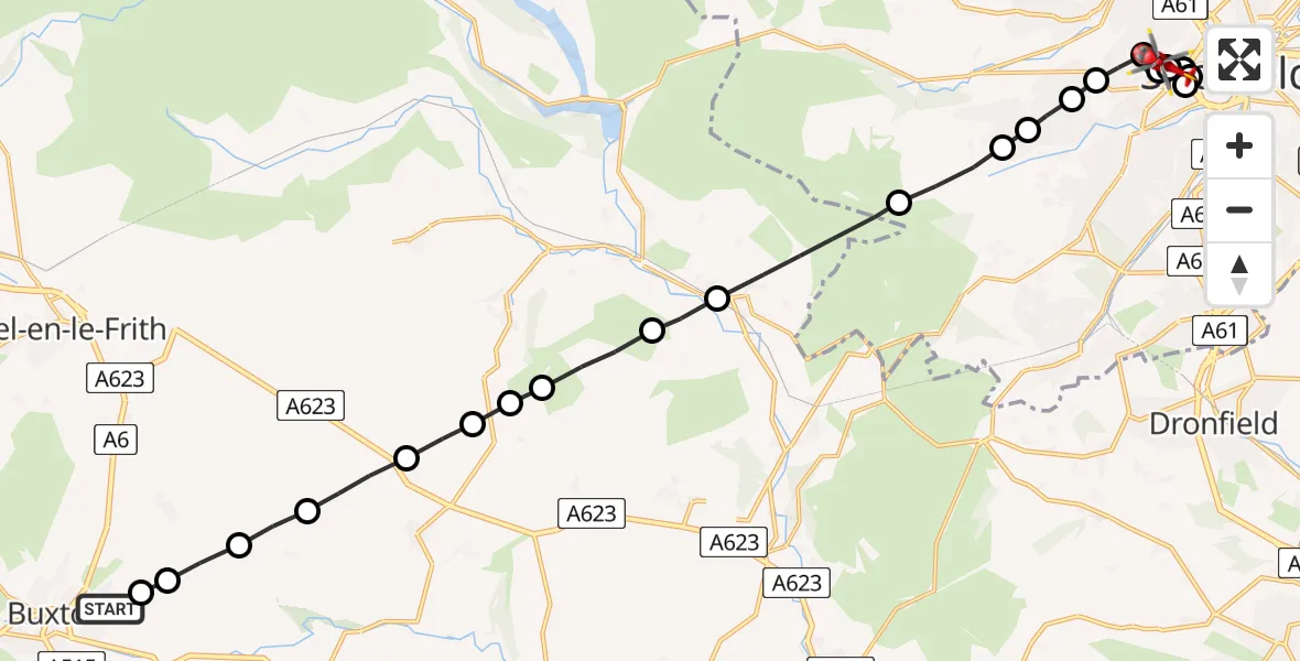
On Monday, 4 May 2026 at 21:29, a Air Ambulance Helicopter departed from Buxton to Broomhill. It was the Air Ambulance Helicopter with registration number G-DRLA. The flight lasted 10 minutes. During that period, the aircraft travelled 21 miles at an average speed of 124 miles per hour at a maximum altitude of 2975 feet.
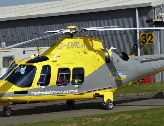
Helicopter: G-DRLA
The helicopter G-DRLA is used as an ambulance helicopter. The helicopter is equipped with a stretcher for transporting patients. The helicopter is often used to transport to hospitals.
Photo: Alec Wilson
21 miles
2975 feet
124 mph
11 minutes
21:29
21:39

Route
Mushroom Lane, South Yorkshire - Sheffield21:39
Netherthorpe, Sheffield21:38
Sheffield Childrens Hospital, Sheffield21:38
Netherthorpe, Sheffield21:38
Sheffield Childrens Hospital, Sheffield21:38
Broomhill, Sheffield21:37
Sheffield Childrens Hospital, Sheffield21:37
Broomhill, Sheffield21:36
Crosspool, Sheffield21:36
Ranmoor, Sheffield21:36
Fulwood, Sheffield21:35
Workhouse Green, Sheffield21:35
Ringinglow, Sheffield21:34
Hathersage, Derbyshire21:33
Derbyshire Dales, Derbyshire21:32
Abney, Derbyshire21:32
Derbyshire Dales, Derbyshire21:32
Little Hucklow, Derbyshire21:31
Tideswell CP, Derbyshire21:31
Wheston CP, Derbyshire21:30
Tunstead, Derbyshire21:30
Peak Dale, Derbyshire21:29
High Peak, Derbyshire21:29
Dew Pond Lane, Derbyshire21:29
Today
Police Helicopter to Monifieth03:27:33
Flights Broomhill
Air Ambulance Helicopter to Broomhill24 Jul 17:57
Flights Buxton
Air Ambulance Helicopter to Buxton, Cawston Road22 Jun 16:55
Air Ambulance Helicopter to Buxton, Aylsham Road10 Jun 18:05
Air Ambulance Helicopter to Buxton, Green Lane27 May 16:32
Helicopter flights on your website?
You can easily display helicopter flights on your own website. Use the embed code.
