Coastguard Helicopter to Kilmuir
Monday, 4 May 2026 | 15:29 | From Cnoc an t-Sithein
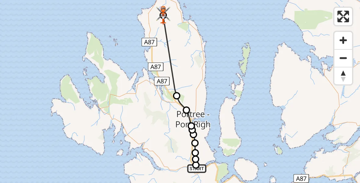
On Monday, 4 May 2026 at 15:29, a Coastguard Helicopter departed from Cnoc an t-Sithein to Kilmuir. It was the Coastguard Helicopter with registration number G-MCGG. The flight lasted 16 minutes. During that period, the aircraft travelled 25 miles at an average speed of 93 miles per hour at a maximum altitude of 1300 feet.
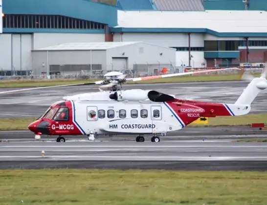
Helicopter: G-MCGG
The helicopter G-MCGG is used by the British Coastguard. The helicopter is deployed in search and rescue operations at sea, rescue operations involving ships or drilling platforms, patrols to prevent smuggling or piracy, environmental monitoring and disaster relief support.
Photo: Mark Harkin
25 miles
1300 feet
93 mph
17 minutes
15:29
15:45

Route
Kilmuir, Highland15:45
Kilmuir, Highland15:45
Annishader - Ainiseadar, Highland15:35
Borve - Borbh, Highland15:34
Portree - Port Rìgh, Highland15:32
Camustianavaig - Camas Tianabhaig, Highland15:32
Highland, Highland15:32
Camustianavaig - Camas Tianabhaig, Highland15:31
Portree - Port Rìgh, Highland15:30
Highland, Highland15:30
Caiplach, Highland15:29
Cnoc an t-Sithein, Highland15:29
Live flights
Police Helicopter on its way from Wrenthorpe2 Aug 22:03
Today
Police Helicopter to Glasgow, Edzell Court2 Aug 22:27
Police Helicopter to Mollinsburn2 Aug 22:20
Air Ambulance Helicopter to Cardiff Heliport2 Aug 21:45
Police Helicopter to MOD St Athan2 Aug 21:32
Flights Kilmuir
Coastguard Helicopter to Kilmuir12 Jul 10:34
Coastguard Helicopter to Kilmuir12 Jul 09:58
Coastguard Helicopter to Kilmuir1 Jul 16:33
Coastguard Helicopter to Kilmuir1 Jul 16:22
Coastguard Helicopter to Kilmuir4 May 15:29
Coastguard Helicopter to Kilmuir28 Apr 15:14
Coastguard Helicopter to Kilmuir28 Apr 15:10
Coastguard Helicopter to Kilmuir28 Apr 15:06
Air Ambulance Helicopter to Loch Luichart11 Apr 08:20
Helicopter flights on your website?
You can easily display helicopter flights on your own website. Use the embed code.
